
Bucktail channel rehabilitation site, at the artificial beaver dam (or 'beaver dam analog') that supports a wetland along a side channel. Constructed summer of 2016, photographed March 2018.
After the Dark Gulch rehabilitation site construction was originally completed in 2008, several factors led the TRRP to initiate a new rehabilitation site at Bucktail. As with previous channel rehabilitation projects on the Trinity River, the Bucktail channel rehabilitation project was designed to increase aquatic habitat for salmonids over a range of flow conditions by creating hydraulic and ecological complexity in the form of in-channel and riverine elements.
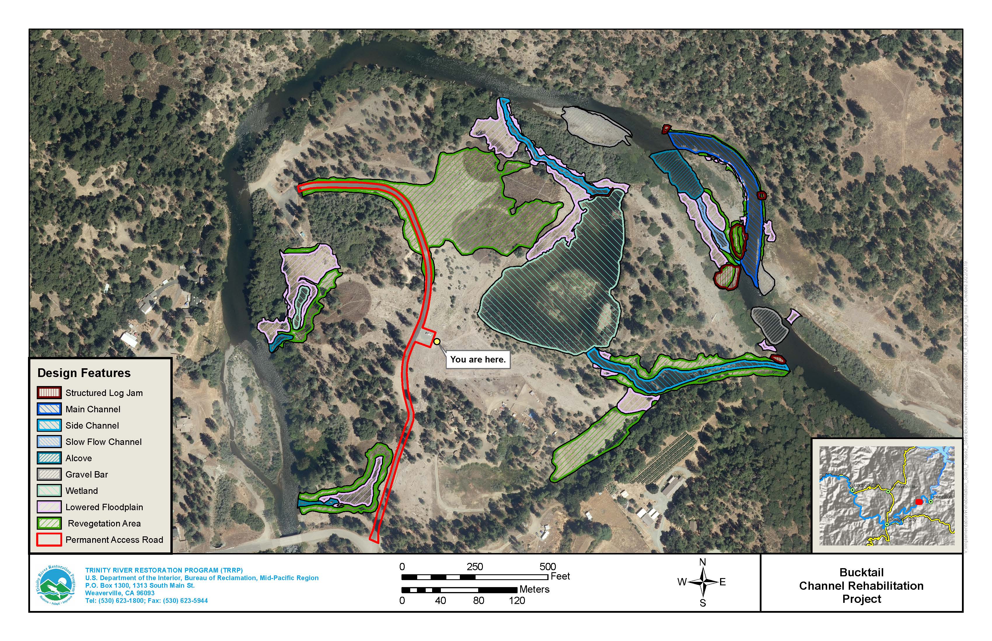
Bucktail Built Design Features
The Bucktail channel rehabilitation site was designed to build and sustain dynamic mainstem bar (point, medial) and riffle morphology, and off-channel rearing areas designed to increase and sustain the availability, quantity, and quality of anadromous fish habitat between 300 cfs and 2,000 cfs for all life stages. The design elements for the Bucktail channel rehabilitation included mid-channel islands, split flows, side channels, wetlands, alcoves, lowered floodplains, large wood/boulder habitat structures, and riparian revegetation. Site-specific design features are intended to evolve over time under the congressionally mandated flow releases described in the ROD.
Further Information:
- Bucktail map showing built design features (pdf)
- Draft Environmental Assessment / Initial Study (EA/IS) (pdf) and Checklist (pdf)
- Final EA/IS with signed Finding of No Significant Impact (FONSI) (pdf)
- Map of site design excerpted from EA/IS (pdf)
- Changes to Federal Emergency Management Agency (FEMA) Base Flood Elevations (BFE) based on as-built conditions. These differ slightly from the elevations initially calculated in Spring of 2018 (due to response to comments), but there remains no rise in BFE at insurable structures. [Updated October 2018]
- Notification from Trinity County on changes for properties.
- Exhibit A: Completed project with approximate parcel boundaries (PDF map; pending approval from FEMA).
- Exhibit B: Forecast changes to FEMA Base Flood Elevation at flow modeling cross sections (PDF map; pending approval from FEMA).
- Exhibit C: FEMA Flood Hazard Zone boundary changes (PDF map; pending approval from FEMA).
- Online maps (web pages):
- Aerial photography: [1944], [1960], [1980], [2016] (other years available too – note controls at bottom of screen)
- Channel Rehabilitation site design (this will overlap Bucktail and Dark Gulch sites)
- TRRP 2016 Annual Report (pdf)
- Search TRRP online library for “Bucktail” (web page)
Although still early in the year, vegetation is recovering and greening-up at Bucktail. Photo taken March 2018.
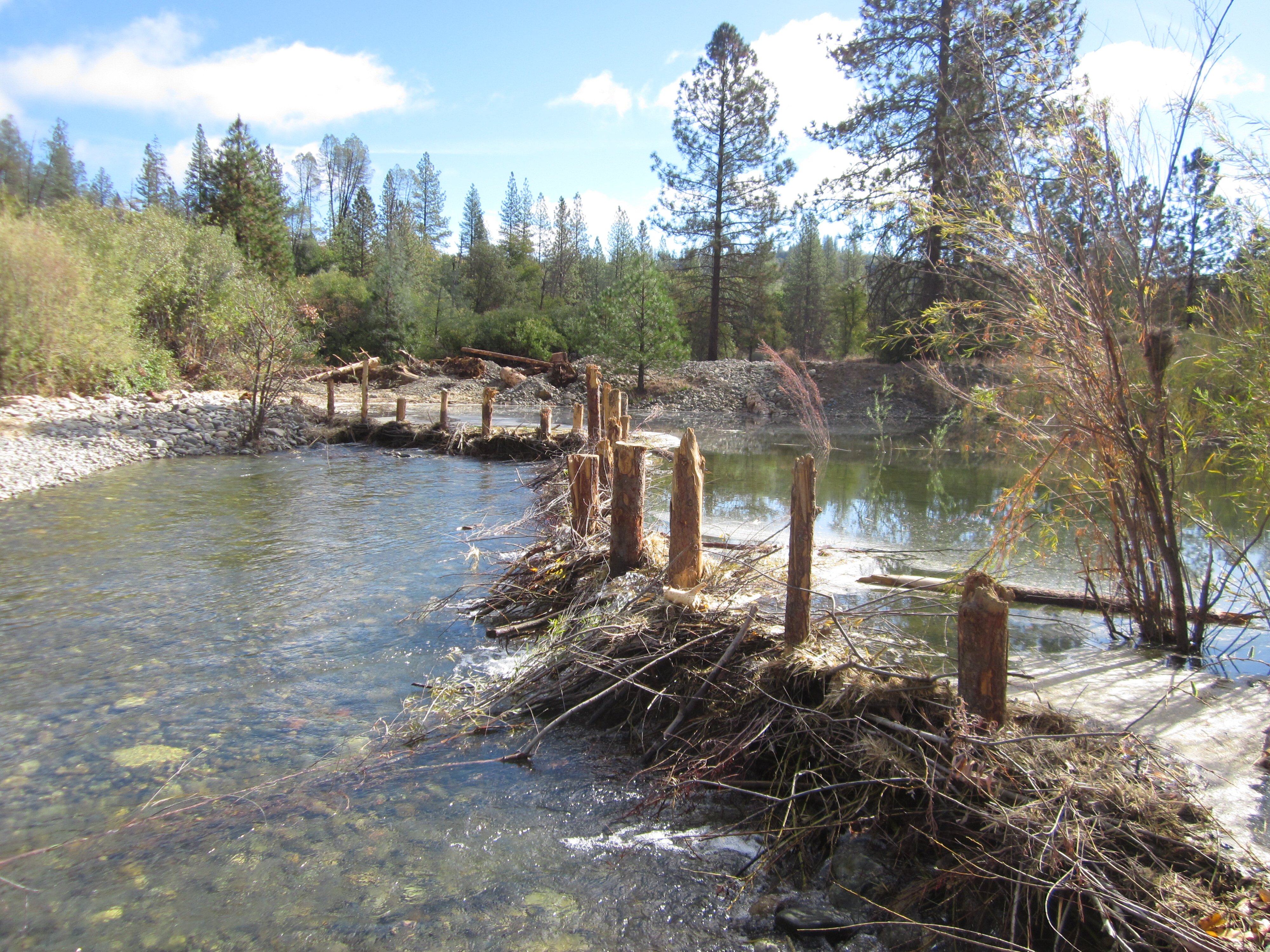
Bucktail channel rehabilitation site, at the artificial beaver dam (or ‘beaver dam analog’) that supports a wetland along a side channel. Photographed 2016 shortly after construction.
Bucktail channel rehabilitation site, upper portion of side channel. Note the abundance of aquatic invertebrates. Constructed summer of 2016, photographed March 2017.
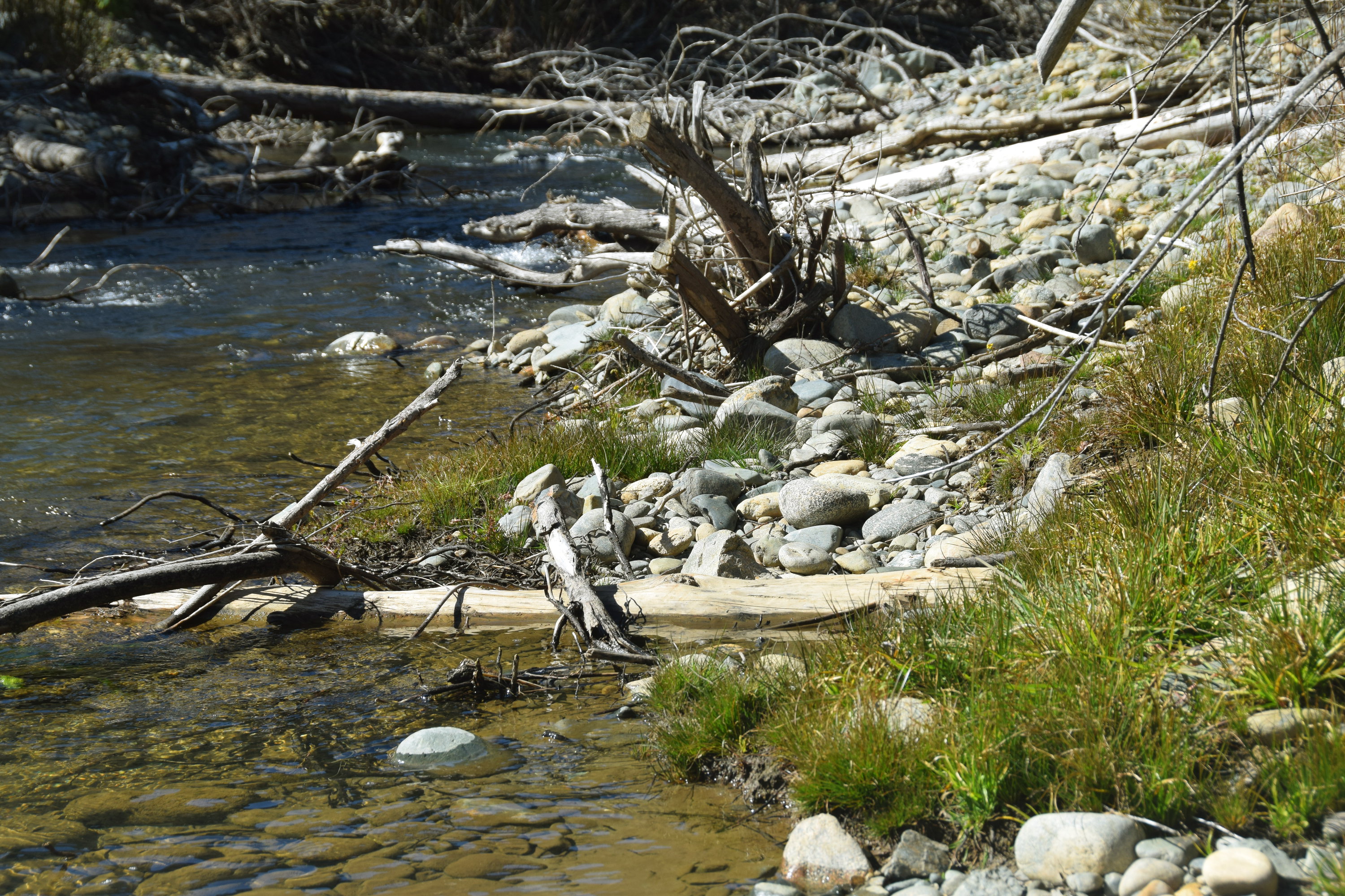
Bucktail channel rehabilitation site, side channel below the wetland. Constructed summer of 2016, photographed March 2017.
Bucktail channel rehabilitation site, large wetland along a side channel. Constructed summer of 2016, photographed April 2017.
Bucktail channel rehabilitation site, side channel below wetland. Constructed summer of 2016, photographed March 2018.
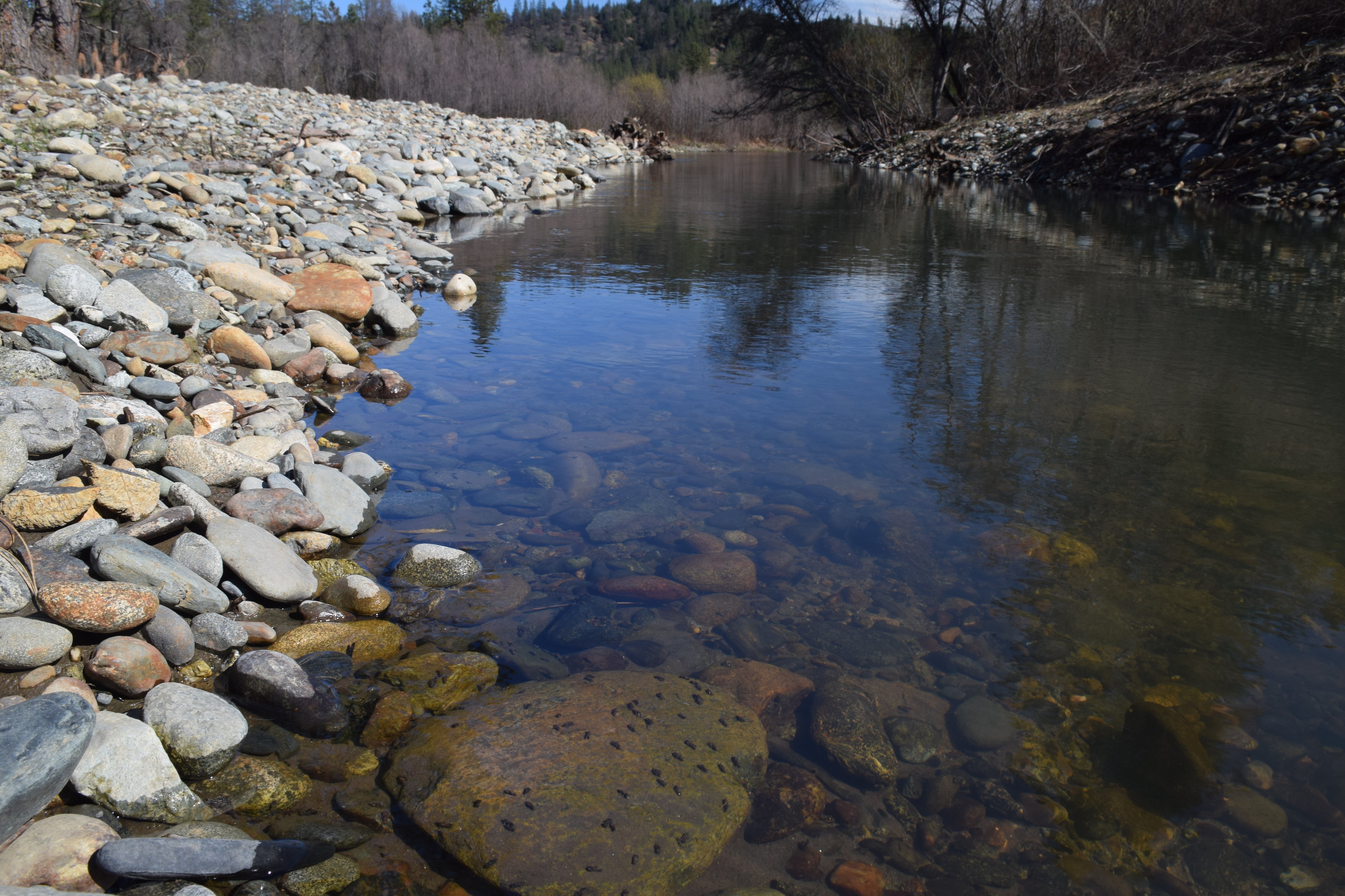
Bucktail channel rehabilitation site, side channel above wetland. Constructed summer of 2016, photographed March 2018.
Bucktail channel rehabilitation site, at the artificial beaver dam (or 'beaver dam analog') that supports a wetland along a side channel. Constructed summer of 2016, photographed March 2018.