By: Michael Dixon, Executive Director – Trinity River Restoration Program
Drone photo of the Oregon Gulch site in the summer of 2025. [Elliot Sarnacki, TRRP]
As we enter 2026, let us pause to reflect on this past year, which was the 25th year of the Trinity River Restoration Program. I’m sure that most will agree that 2025 felt decidedly tumultuous, but we managed to overcome a lot of hurdles and get important work done.
Although we said goodbye to an unprecedented number of TRRPers from across our partnership, the pace of our work did not slow down. While we cannot replace the friendships and personalities of our colleagues who no longer roam our meetings and hallways, those that remain have showed great resolve in their dedication to this program and its mission.
Last year, we completed the Watershed Restoration EA, an ambitious document that will dramatically streamline the environmental compliance process for not just the TRRP’s restoration work, but also for other partners in the watershed. The document was a collaboration with the Bureau of Land Management, the US Forest Service, and our office, and was a heavy lift by many dedicated individuals over several years. We are already seeing the benefits of their hard work with the 2026 construction season approaching.
We abruptly lost our long-term outreach grant with the Trinity County RCD late last spring, but our relationship with them endures. We are actively working on ways to share capacity and continue the work that we do together. Popular events like Science on Tap and youth outreach camps such as the Weaverville Summer Day Camp will continue into 2026.
The Upper Conner Creek restoration Project was completed in 2025. [Elliot Sarnacki, TRRP]
We completed the Upper Conner Creek restoration project. The project rehabilitated nearly 15 acres of floodplain habitat and filled a final puzzle piece of a patchwork of channel restoration projects both up and downstream of the area. The design was the third largest design we have ever implemented in terms of excavation volume. This project saw a significant amount of input from partnerships and stakeholders, leading to a project that met the needs of many while keeping the goal of habitat enhancement for fish and other wildlife at the center. Watching flows from these last several December storms spread out on all that new floodplain has been very exciting – the site looks great and we look forward to watching it evolve.
Speaking of flows, we are now in our second year of implementing the full winter flow project ruleset to better manage and study our environmental flows. For a second year in a row the atmosphere delivered a Christmas storm triggering a synchronized storm pulse. This flow gave the river a healthy scrub (especially up by Deadwood Creek) and set the stage for a vibrant food web to develop as salmon emerge from the gravel.
In the broader Klamath-Trinity watershed, we saw an incredible, unhoped-for number of adult salmon pass the former Klamath dam sites and make it into the upper watershed. Partners in the program were instrumental in making that happen, and there is little doubt the dam removals will pay dividends for the Trinity as well – a rising tide lifts all boats.
Mike Dixon is the Executive Director of the Trinity River Restoration Program and a northern California native. He fell in love with the Trinity River and Klamath Mountains while assigned to his first duty station at Coast Guard Air Station Humboldt Bay. He received a Ph.D. in Conservation Biology from the University of Minnesota, Twin Cities, where his dissertation focused on the landscape ecology and population genetics of bats. He lives on a small, perennial tributary of the Trinity River near Weaverville.
By: Kiana Abel, Public Affairs Specialist – Trinity River Restoration Program
Family: Lycosidae
Wolf spiders are an incredibly common spider worldwide with 2400 described species that range in many different habitats, vary in size and coloration, have incredible eyesight and hunt by ambushing, chasing, pouncing and or tackling its prey. In fact, wolf spiders are classified to the Lycosidae family of arachnids, so named after the Greek word (from Ancient Greek λύκος (lúkos)) for wolf due characteristic hunting tactics of the two species.
Thin Legged Wolf Spider [Howard Bruner, inaturalist – Lewiston]
Carolina Wolf Spider (Hogna carolinensis). [wikimedia commons]
McCook’s Split wolf spider (Schizocosa mccooki). [Joaquin Hale – Lewiston]
California is home to more than 120 species of wolf spiders, ranging from tiny ground dwellers in the genus Pardosa (thin legged wolf spider) to the quite large Hogna carolinensis (Carolina wolf spider). When discerning between genera of wolf spiders, they can be very difficult to identify in the field without holding each type in your hand [or by using this genius method]. Although the wolf spider’s bite is not dangerous to humans (akin to a bee sting) capturing one on camera or in your hand can be difficult because they are fast – and they are, well. Mostly big. Also hairy. And a spider.
Commonly all wolf spiders share traits such as parental care, eight eyes, active hunting techniques and coloration that hides them within their habitat. Knowing these identifying factors, the wolf spider can be distinguished quite easily from other common California spiders such as the brown recluse look alike, Titiotus californicus, tarantulas or black widow.
Desert Tarantula(c) LJ Moore-McClelland via iNatrualist
Western Black Widow. [Joaquin Hale – Lewiston]
Within the Lycosidae family there are 56 described spiders in the genus Schizocosa. Schizocosa mccooki, commonly known as the McCook’s Split Wolf Spider andcan be found in Trinity County. This spider is identified by its medium sized (about 1.5 inches) hairy body, active hunting style, eight eyes (two very large center eyes, four under and two upper eyes) and a distinctive “heart mark” on its abdomen. Most individuals live one year, with mating typically occurring in late summer or fall.
The rearing and mating process for wolf spiders is unique in the spider world. Common to female wolf spiders, S. mccooki carries her egg sac attached to their spinnerets at the end of their abdomen until their spiderlings hatch. Once hatched, the juveniles remain on their mother’s back until they are ready to disperse into the world.
Wolf Spider Mothers Carry their Eggs – YouTube
Common to male Schizocosa is a complex leg-drumming display used to attract females during mating season. A 2022 study, published in Biology Letters, indicates that males use specific vibratory signals to court their desired female, creating unique and more complex patterns for larger females – the study hypothesizes this may be due to choosing a female that has a large carrying capacity for juvenile spiders once hatched (Choi etal, 2022). The study also found that females picked males with complex coordination of differing signals that may indicate her suiters athleticism (Choi etal, 2022).
Wolf spider, Schizocosa stridulans male courtship – YouTube
Spiders typically have eyes that suit their hunting styles, and unlike web-building spiders, wolf spiders rely on keen eyesight to capture prey. As mentioned earlier, wolf spiders have eight eyes, with a large pair front and center. Their eyesight is enhanced by a interior reflective layer called the tapetum lucidum that helps to shine light back into the spider’s vision effectively enhancing low-light conditions that aide them in nocturnal predation.
Tapetum lucidum is an evolutionary feature found in both predators and prey such as cats, deer, cows, and some spider species. If you are ever interested in hunting wolf spiders, simply head out with a headlamp on a moonless night, shine your light into the grass and look for two reflective eyes shining back at you from the darks of your backyard.
Araneomorph spider of which wolf spiders are categorized. Anatomy from Spidentify
Wolf spiders possess forward-pointing chelicerae, an appendage that almost resembles a well groomed mustache yet operates to aid immobilizing prey while fangs deliver venom at it’s tip. In wolf spiders, the chelicerae are relatively large and well-muscled, giving them the strength to subdue struggling insects during active hunts. Viewed closely, the chelicerae appear dark and glossy, sometimes with fine hairs, and the fangs curve slightly inward at the tips. This arrangement is both efficient for piercing prey and distinguish them from other spider groups such as tarantulas, whose fangs move vertically rather than side-to-side.
In S. mccooki, the chelicerae are proportionally large relative to the spider’s body size and are typically dark brown to black with a polished sheen that contrasts against the lighter patterned cephalothorax. Strong internal muscles allow the fangs to strike with enough force to quickly immobilize prey such as beetles or crickets. Fine sensory hairs line the cheliceral margins, helping the spider detect movement and handle struggling prey. In males, the chelicerae can also serve a communicative role, sometimes being lifted or vibrated in coordination with leg-drumming during courtship.
A Riparian Predator & Prey
Riparian corridors are home to a wide range of species that link terrestrial and aquatic food webs. Among these, the wolf spider is a key ground-dwelling predator that helps regulate insect populations and provides prey for higher trophic levels.
Wolf spiders are widespread in open habitats such as grasslands, chaparral, and riparian habitats where cobble bars, woody debris, and leaf litter provide hunting grounds and cover. These microhabitats are important refuges not only for wolf spiders but for the many insects they consume. As wolf spiders actively stalk prey such as earwigs, beetles, ants, and crickets, consuming them helps moderate insect communities which indirectly supports plant health thus contributing to ecosystem stability. S. mccooki and other wolf spiders also contribute to cross-boundary energy flow by serving themselves as prey for birds, amphibians, reptiles, and mammals.
Mccooks Split Wolf Spider carrying its eggsac. [Martin Galli, inatrualist]
Recognizing the ecological functions of wolf spiders highlights why observation is often a better response than eradication. These spiders are integral components of riparian and terrestrial ecosystems, regulating insect populations and serving as prey for higher trophic levels. Their hunting strategies, reproductive behaviors, and physiological adaptations illustrate the complexity of predator–prey interactions that sustain biodiversity. By taking time to identify and observe a spider before removing or killing it, we not only learn more about local species but also foster an understanding of the interconnected roles that maintain ecosystem stability. In this way, simple curiosity can translate into conservation-minded awareness.
As Public Affairs Specialist for the Trinity River Restoration Program, Kiana manages external communications, media relations, and stakeholder outreach. She acts as a liaison between program initiatives and the public, transforming technical findings into compelling narratives that promote understanding of restoration initiatives on the Trinity River. Kiana holds a Batchelor’s in Art History, has spent most of her career in marketing and is focused at the TRRP on bridging the gap between public awareness and resource restoration and management.
On the left is poison oak, and the right is skunk brush. Notice the distinct ‘stem’ on the central leaflet on the poison oak plant. Skunk brush leaflets do not have this feature. [Simone Groves, Hoopa Valley Fisheries Department]
Editor’s note: The shrub with the common names which include skunk brush, basket bush, fragrant sumac, lemon sumac, and lemonade bush is known across North America as both Rhus trilobata and Rhus aromatica. The nomenclature in this document follows McBain and Trush (2005) and refers to the plant as Rhus trilobata.
Have you ever walked in the woods and tried to identify poison oak along the path? Some folks walk with extreme caution as soon as they step from pavement and defined trails, driven by fear of injurious rash caused by this plant. The most common way that I hear folks identify poison oak is through a common rhyme “leaves of three, let it be.” This is an easy phrase to remember, but there are some loopholes in this simple rhyme. There are several look-alike species that cause no harm, and are in fact quite tasty, and can be eaten. Let’s start with the commonly defined ID features used in the Jepson manual to distinguish the two genera.
Poison Oak (Toxicodendron diversilobum) has axillary flowers which appear between the leaf axles with a pedicel, or stem at the base which causes the flowers and fruit to be spaced apart; leaflets adaxially shiny or oily-looking on the top; fruit creamy white or papery looking.
Skunk brush (Rhustrilobata) (also called basket bush, lemon sumac, fragrant sumac, and lemonade bush) flowers appear on the ends of the branches, also called “terminal”; flowers are often nearly sessile or appear tightly packed; leaflets dull, not very shiny; fruit red and often sticky. There’s an interesting additional flower mannerism in skunk brush – the flowers often are only male or only female on individual plants, but sometimes bisexual flowers can also be found on plants, this term is called polygamodioecious. This is why a whole area will have no fruit, and then a patch of plants might be loaded full of fruit.
Speaking of its red fruit, skunk brush’s other common names, lemonade bush and lemon sumac, refer to the berries. They have a sour, lemony flavor to them. It is said that early pioneers steeped the berries in water, and then added sugar to make lemonade. The berries are also eaten directly and are considered an important food source by some Native American tribes. Many wild animals consume the berries of both poison oak and skunk brush, particularly birds and small mammals, although they are not a preferred food source. Their tendency to stick to the stems through the winter makes them good emergency food for animals when other foods are scarce.
Skunk Brush (Rhus trilobata) with fall berries. [Simone Groves, Hoopa Valley Fisheries Department]
Expanding beyond the features that the Jepson uses for ID there can be a lot more subtlety of distinguishing observations between the two species. The more that you look at these two, the more you will learn to differentiate between them in your own way! Here are a few more features that I have noticed over the years.
Leaves
Remember “leaves of three, let them be”? Well the more accurate saying should be, “leaflets of three, let them be” because according to plant anatomists, the three “leaves” on a poison oak plant are actually a single leaf, divided into three leaflets. Poison oak appears to have a stem on the terminal leaflet which separates it from the basal lobes. The leaves often have 3-dimensionality to them, either with ruffled edges, or a central crease along the midrib of the leaf, with venation standing out as slightly white when viewed from above. Any leaf features on poison oak can be highly variable and thus expect it to surprise you at times. As field botanists often joke that poison oak will often take on the look of nearby plants.
Skunk brush tends to have the front leaflet be a little larger and the back appear slightly reduced in size. These leaves do not have a stem attaching the leaflets together. The leaves tend to be extraordinarily flat or could be described as “2D.” Often times the venation is only distinctly visible from the abaxial or underside of the leaf. Sometimes there is a little trench-like crease from the topside but the veins don’t stand out looking down on it.
The last feature that is helpful for differentiating these two species, is the color and mannerisms of the stems of each plant, even when dormant. Poison oak tends to have yellowish stems, often times with hibernating buds that look like little pink primordial hands. Poison oak is also known for making little adventitious roots on the branches which helps it climb trees and spread aggressively over the ground. It isn’t unusual to see poison oak growing as either a shrub or a vine (but it’s not the same as ‘poison ivy’, which is not found in California.
The “yellowish” stems of poison oak. [Simone Groves, Hoopa Valley Fisheries Department]
Skunk brush has branches that look ashy grey or pinkish purple and in early spring they tend to be layered in a tender fuzz that is reminiscent of the velvet covering a young deer’s antlers. Also, the smell of skunk brush is distinctly pleasant, both when cut and when burned. One might imagine these sticks being used for incense, or something similar.
The tender fuzz covered stems of skunk brush. [Simone Groves, Hoopa Valley Tribal Fisheries]
Both species tend to come out of winter dormancy around the same time. However the first features to awaken in poison oak are its new shiny leaves, whereas the first feature to appear for skunk brush, are the flowers. Often times the timing of this awakening from dormancy is highly variable year to year and can track the warmth changing around the landscape in a very intimate way.
Comparison of the two species in early spring when poison oak shows leaves first and skunk brush’s flowers are first. [Simone Groves, Hoopa Valley Fisheries Department]
Initially, botanists placed both poison oak and skunk brush in the same genus- Rhus. This name is Greek for ‘rhous’ which means flow, or stream. Some have thought that this might refer to the sticky sap that is excreted when cut, but others have rejected this claim. The reclassification of poison oak to its own genus “Toxicodendron” occurred in the early 20th century as the genus was given definition and separated out those representatives within Rhus that caused skin irritation. Toxicodendron means “poison – tree” in Greek which was also a contentious definition because technically the plant is not poisonous, but is an irritant, and in fact has many medicinal and beneficial properties. In Hupa language the word for poison oak is k’e:k’ilye:ch’. In Yurok the word for poison oak is me’yk’welep’. The Karuk word for poison oak is kusvêep.
Urushiol is the chemical present in the Toxicodendron genus that is renowned for irritating the skin. This oil is described as similar to machine oil in its difficulty to remove. Some recommendations suggest removing it using a sudsy soap and an abrasive scrubbing surface under cold water. Also, some home remedies recommend rubbing clay or dirt on fresh oils as it can absorb the oils and reduce the interactions with your skin cells. According to the National Library of Medicine, the reaction caused by urushiol is a Type IV Hypersensitivity reaction which is often stimulated in 48-72 hours after exposure and is a T-cell mediated immune reaction, suggesting that it is the between-cell interactions that cause the body’s immune response to the oils.
Urushiol is the chemical present in the Toxicodendron genus that is renowned for irritating the skin. This oil is described as similar to machine oil in its difficulty to remove. Some recommendations suggest removing it using a sudsy soap and an abrasive scrubbing surface under cold water. Also, some home remedies recommend rubbing clay or dirt on fresh oils as it can absorb the oils and reduce the interactions with your skin cells. According to the National Library of Medicine, the reaction caused by urushiol is a Type IV Hypersensitivity reaction which is often stimulated in 48-72 hours after exposure and is a T-cell mediated immune reaction, suggesting that it is the between-cell interactions that cause the body’s immune response to the oils.
As with many plants in the California landscape, both poison oak and skunk brush have a fire relationship. Although poison oak burning can aerosolize the urushiol, if the fire develops to just the right amount of heat and time of day, a completely safe fire can “stand up” and send the toxic smoke harmlessly into the upper atmosphere. Some indigenous descriptions report that the current prevalence of poison oak in forest understories is due to the lack of short fire return intervals on the landscape. Skunk brush was used by many tribes in California as a basketry stick. These stems were burned, just as hazel was for its shoots. In my personal experience burning with North Fork Mono led by cultural fire practitioner and Tribal Chairman, Ron Good, when the color of the ash turns purple, it can indicate that the fire and embers are the right intensity and is cool enough to cultivate the healthy regrowth of the plant. With burning and fire intensity, ash color and burned soil color as well as charcoal remains can all be an indicators of the temperature of the flames and their effects on the plant and soil communities. For more information dig into the resources at the FRAMES federally hosted fire effects resource page.
A common medicinal concept held by many of the tribes in our northern California region is that the medicine can be found near the cause of the problem. Poison oak is the classic example of this. Mugwort is a strong medicine for neutralizing poison oak, in particular salves made from it, but also a tea, taken internally can soothe the body’s reaction. Other common medicines include manzanita and madrone bark which a cooled tea of these can soothe the blisters and calm the body’s reaction. This idea can remind us that rather than thinking of the world as full of dangers and poisons that lie just beyond the edge of the path, rather that medicines and foods are always near to provide support and soothe the ails that arise along the way.
Simone Groves, Riparian Ecologist, Hoopa Valley Tribal Fisheries
Simone is first generation California transplant of Scottish descent raised in the unceded territories of the Raymatush in the rural west peninsula of the SF Bay where farmers, farm workers and hippies form the heart of the small town. She graduated in 2016 from Humboldt State University with a BS in Botany and has worked in the outskirts of rural Humboldt county on Natural Resource and Land management since 2013. She is passionate about plants and their interactions with dynamic systems as a mechanism for relearning our human-landscape interdependence.
Ceratonova shasta (C. shasta) is a microscopic parasite that is native to rivers of the Pacific Northwest, including the Klamath and Trinity Rivers. Infection is most severe for juvenile salmon but can impact returning adults as well. The impact of an infection is highly influenced by water conditions like temperature, flow, and seasonality. If conditions are right for the parasite’s host worm, C. shasta can rapidly proliferate and lead to severe infections that can be devastating to populations. In 2021, after years of drought that impacted river conditions juvenile salmonid deaths from C. shasta in the lower Klamath reached into the hundreds of thousands [1, 2].
To survive, C. shasta needs two hosts
1. A carpet of tiny worms C. shasta starts its life inside a freshwater worm, called Manayunkia occidentalis. The worm, smaller than an eyelash, lives in mud and on rocks below the surface of a river or reservoir in colonies that can resemble an underwater carpet. Inside the worm, the parasite grows and turns into a new form called an actinospore. Once an actinospore, the worm releases the microscopic parasite to float in the water column and wait for its next host [3].
2. Salmon and Trout As they swim young salmon breath in the actinospores allowing the parasite to attach to the gills and then enter the fish’s body. The parasite then travels to the fish’s intestines, where it multiplies and causes internal damage. This makes the fish sick and weak, causing many to succumb to the infection. The cycle continues when infected fish (including adults) release more spores back into the water after they die.
Jerri Bartholomew Ph.D. explains the complex lifecycle of C. shasta and her discovery of the second host involved in the disease. She presents some of the questions being explored in a collaborative effort to help salmon survive in the Klamath River.
Are Adult Salmon Affected?
Adult salmon can be infected with C. shasta however the severity is influenced by other stressors. Typically, adults encounter the microscopic spores during upriver migration through areas with high spore loads (like the lower Klamath River during spring/summer). If the fish is stressed from high water temperatures, poor conditions or other pathogens, C. shasta could lead to pre-spawn mortality or failure to spawn. Although typically resistant, if infected, adults can act as a carrier of the parasite – shedding spores when they die and decompose. If the spores are shed in a system that does not have adequate flushing flows during the ensuing winter months, juveniles from the area could be affected. While some disease impacts to adult salmon are possible, if conditions in the river are favorable, adults are generally more resistant to effects of the disease than juveniles.
The Klamath River
Salmon health and vitality is of utmost importance for Klamath indigenous groups like the Yurok, Quartz Valley, Karuk, and Hoopa Valley Tribes. For millennia salmon have provided sustenance and are celebrated as integral to the health of people, culture, tradition, and economy. The continued decline of salmon due to C. shasta and other human-enhanced factors are deeply felt by local people and led to the decade’s long advocacy to remove four hydroelectric dams on the Klamath River.
In 2023 and 2024 these dams on the Klamath River were removed, allowing salmon, steelhead and lamprey to reconnect to 400 miles of spawning habitat. It is the largest dam removal project in U.S. history, to date. Ecological goals for dam removal are to improve water quality, restore resources to Klamath River Tribes, restore habitat for salmonid species, and improve the health of salmon and steelhead [5].
The Klamath River is home to several salmon species that are important to Native American tribes, commercial and recreational fishers, and the ecosystem as a whole. Although infections occur in all species of juvenile salmon or trout, if the parasitic worm host is allowed to thrive, results can be devastating for some salmon species. One such species of concern are Coho salmon, which are recognized as “threatened” in the Klamath and the Trinity and are especially vulnerable to population scale impacts from large scale fish kills propagated by parasites.
Toxic algal blooms were a problem in the stagnant waters sitting behind the dams on the Klamath River since the dams were built. Photo by Stormy Staats/Klamath Salmon Media Collaborative via KRRC.
What made the lower Klamath River a hotspot for C. shasta? Below Iron Gate dam, the primary reasons were twofold. First, scouring events from winter storms were blocked by dams failing to disperse sediment. Second, waters held in several chains of reservoirs warmed. Ultimately these combining factors led to robust habitat conditions for the parasite’s aquatic worm host. Fish heath experts in the Klamath Basin are hopeful that dam removal will mitigate previously favorable growing conditions for the host worm [6]. Removal of JC Boyle, Copco 1 & 2 and Iron Gate dams will allow for a more natural flow of water from tributaries and potentially help to scour growth of the host worm with winter storms.
Hope for Trinity River Fish Populations
The Trinity River joins the Klamath River approximately 44 miles above the ocean, so its fish are subjected to the conditions of the lower Klamath River during their migrations. Beginning in late winter juvenile chinook begin to migrate downriver feeding on drift invertebrates, resting and digesting in warmer slower waters. Once they meet the mild saline waters of the Klamath estuary, they begin a smoltification process where their bodies change and adapt from freshwater to saltwater. Cold temperatures and salinity may reduce progress of disease, but do not eliminate infection [1].
Because of their migration paths, Trinity River fish populations were part of the juvenile fish kill on the Klamath River in 2021. This event, along with historic drought conditions that followed, allowed for pathogens like C. shasta to play a significant role in returning adult escapement. Since most Chinook exhibit a 3-5 year life cycle, we’re still experiencing the loss of these juvenile fish today. Historically low returns of adult chinook salmon have prompted recreational fishery managers to close in-river salmon fishing seasons for a third consecutive year [8, 9]. Although the immediate impacts have been devastating for recreational anglers and river enthusiasts, there are many hopes (and also many unknowns still to be learned) following the removal of the dams. The primary hope for Trinity River outmigrant fish to experience less frequent and less severe infections once they reach the Klamath River so that juveniles as well as adults can manage natural stressors and thrive.
Klamath Fish Health Assessment Team
The Klamath Fish Health Assessment Team (KFHAT) is a technical workgroup which formed during the summer of 2003 with the purpose of providing early warning and a coordinated response effort to avoid, or at least address, non-hazardous materials related fish kill events in the anadromous portion of the Klamath River basin [10].
To accomplish this goal, KFHAT created a network of experts and monitoring efforts through which information about current river and fish health conditions in the Klamath Basin can be shared among participants, the general public, and resource managers.
Every year, beginning in late April, members of KFHAT hold meetings to assess Klamath Basin fish health along the Klamath and Trinity Rivers and their main tributaries. The group publishes observations as well as a readiness level map based on those observations on a public facing website: Klamath Fish Health Assessment Team (KFHAT) after each meeting.
How are juvenile populations fairing this out-migration season? The wet winter of 2024/2025 has set the system up with favorable fish health conditions, but our area’s typical hot July weather can lead to stressful lower river environments. Thus far the 2025 monitoring season has seen some irregularities with regards to concentration of C. shasta. Klamath Basin water quality monitoring is implemented annually by a team at Oregon State University and recent monitoring results are showing higher than normal spore counts of C. shasta in geographic areas that are puzzling scientists [10]. In the lower river, screw traps are catching Trinity River hatchery-released yearlings from the fall and spring brood stocks with infections [10]. Although these conditions exist each year, they vary in severity and salmon evolved to this specific weather pattern. The species stay healthy by seeking cold water refugia located in deep stratified pools and cold-water tributary mouths during the hottest weeks of the year. Also typical to the area, wildfire can aid conditions when smoke sits in drainages, reflecting the sun’s heat back into the atmosphere and therefore cools air and water temperatures.
Although this year’s conditions thus far are concerning (note the yellow readiness levels in the map above), many juvenile salmon are in the last stages of migration to the ocean and are likely in the lower Klamath river undergoing smoltification or learning to live in their new ocean environment. What will conditions be when they return to spawn in our river in 2028, 2029, or 2030? Of course, only time can tell, but with the removal of four Klamath Dams, river managers are hopeful that, when it comes to controlled conditions, Trinity and Klamath run salmonids will have a more favorable environment than what populations have encountered for over six decades, and they might be more favorably armed to withstand what mother nature may bring their way.
Thank you to Dan Troxel, California Department of Fish and Wildlife lead on the Klamath Basin Fish Health Assessment Team and Morgan Knechtle from California Department of Fish and Wildlife for providing detailed edits to this article.
As Public Affairs Specialist for the Trinity River Restoration Program, Kiana manages external communications, media relations, and stakeholder outreach. She acts as a liaison between program initiatives and the public, transforming technical findings into compelling narratives that promote understanding of restoration initiatives on the Trinity River. Kiana holds a Batchelor’s in Art History, has spent most of her career in marketing and is focused at the TRRP on bridging the gap between public awareness and resource restoration and management.
Oak woodlands near Weaverville in 2020. [Kiana Abel, Trinity River Restoration Program]
As the weather starts to warm, California’s hillsides turn golden as grasses dry and take on a reflective sheen. Not only does California’s nickname “the Golden State” refer to it’s historic connection to the gold rush, it also refers to the rolling golden hills of native flowers, like the California golden poppy and less distinct but no less important the native grasses of California. California’s grasslands are a subtle and complex community of individuals which each invite the passerby to slow down and look carefully. One can also trace the last vestiges of water and see where the moisture lingers on the landscape. These last little patches of green show photosynthetic organisms reluctant to take shelter from the summer heat.
Historically it was farmers who were in touch with the detailed eye and mind tuned to the life cycle of grasses. To be a farmer who makes hay, is to understand the boom-and-bust lifecycle of being a grass. As many ranchers will say – being a rancher is really learning to be a grass-farmer. It is an intimate relationship to learn the rhythm of grass growing, to slow down and tap into the cycle. There is a critical threshold in the season, where all the grasses race at a break-neck pace to produce seed. As part of a grass’s strategy, it tracks day-by-day weather in a race to produce and distribute seed in the heat of summer. As a hay producer, it’s best to harvest your hay before all the energy has gone up into the seed and hardened off. This will allow some of the sugars to be readily available for consumption when an animal goes to eat it. If the grass is too far along towards producing its seed, the sugars in the grass become all locked up and stored into their long term, harder to digest form.
If you’ve ever been curious about grasses, Trinity County has some beautiful remnant examples of grasslands clinging on to the edges of areas where mining did not bury their seeds beneath the sorted rocks. When identifying grasses, I find that it can be easiest to start with the things that you’ll see a lot of and try to find “friends” in the population. Each person relates to plants differently, but I find that it can help to try to find a few native grasses and a few non-native grasses to learn to train your eye to their differences. Knowing a handful of native and a handful of non-native grasses is a great place to start.
Here is Bromus diandrus or “rip gut brome” [iNaturalist John Lynden] so named for its ability to get the long awns of the plant (the bristle or hairy growth that helps carry a seed) all tangled and poking into the skin, mouth or gut of herbivores munching in grasslands. Rip gut brome was introduced to California from European Mediterranean areas and is considered invasive and harmful to crops and foragers alike.
Because grasses are difficult to discern, I’ve noted to visit and reexamine them as the season progresses. With each stage of development from flower to seed each species can change significantly showing their true colors. As Bromus diandrus develops it changes colors and can look quite purple.
Here’s a common native grass that looks quite similar to Bromus diandrus. A cousin to B. diandrus, this is Bromus carinatus or California brome [Rob Irwin via iNaturalist] which is a native bunch grass that can be found in many types of habitat.
California brome pollinates via wind, is a great asset in erosion control and is well adapted to survive under a regime of frequent fire. It is also an important food for bear, elk, black tailed deer and seed eating bird species of California.
Look closely when comparing these two brome species by looking at the hair-like awns sticking out of the flower.
In this photo B. carinatus is on the Left and B. diandrus is on the right. [Simone Groves, Hoopa Valley Tribal Fisheries Department]
Non-Native Grasses
As livestock were introduced to California, farmers often seeded grasses as forage so their animals would be well-fed where they landed. The easy and short list of these species is a great starting place to begin to recognize grasses. These species include orchard grass (Dactylis glomerata), rye grass (lolium perenne), wild oats (Avena sp). Avena or wild oats are the same oats that we eat for oatmeal or give to our horses for grain.
And now for some of the native species of grasses! There are three classics to get to know in our area which are blue wild rye (Elymus glaucus), California oatgrass (Danthonia californica) and purple needle grass.
Blue wild rye (Elymus glaucus)
This grass is a tall hearty looking grass with a large seed. It’s very hard to photograph the whole seed head because it is so long and tall, but once you get to know this plant it’s quite distinct. Blue wildrye provides excellent habitat for birds, mammals and waterfowl, can be used to stabilize streambanks, and is very tolerant to fire. Early in the season it provides forage and the seed is an excellent summertime food source for native mammals and birds [USDA Blue Wildrye (Elymus glaucus) Plant Guide].
California Oatgrass(Danthonia californica)
Danthonia as the genus that represents a variety of native oats, and when you tune your eye you’ll notice slight variation within the group along with some similarities. Their inflorescence (arrangement of the flowers on a plant) is composed of 3-5 spikelets and it is a pretty distinct recipe once you start to recognize it. They have relatively short peduncles (stalks that hold the flower or seed), only about 1-2 feet above the ground and their most distinctive feature are their “hairy arm pits.” Danthonia tends to have very hairy leaves and sometimes particularly long hairs right where the leaf separates from the stalk. Danthonia also looks to me like a little field of tiny stars, as they stand in such a distinct pattern along the ground.
California Oatgrass (Danthonia californica). [iNaturalist]
Lastly, Stipa pulchra, recently renamed to Nassella pulchra and commonly known as purple needlegrass is a grass that I – personally as a plant person – have heard a lot about throughout the state. Purple needle grass is the most widespread native grass in California and was named the “state grass” in 2004. In my experience I’ve have never seen it doing quite as well as the populations you can find here in Trinity County. This plant has long awns similar to rip gut brome but is soft to the touch while brome is typically quite coarse and harsh.
Purple needlegrass is drought tolerant and produces a lot of seed which helps to suppress non-native grass species. This grass supports native oak habitats and provides nursery habitat for caterpillars and butterflies of California.
Getting to know grasses is a process of revisiting them frequently to see the way that they change through the year. Touching and observing their basal leaves versus their flowering stalks can help you get to know the ways that they are similar and different from each other. To me, the jovial angle that each grass holds its seed is an expression of its personality and projects attitude. As the seeds mature, usually the stems of the grass start to grow heavy, and once the seeds are dispersed, they’ll spring back up again.
Grasses are a huge part of the plants that we see in our daily lives. Their role creating tiny holes for insects to live in and deep roots which hold our soils together are foundational to a healthy landscape. It’s easy to overlook the niche of grasses when we all spend much of our time trying to weed whack them down. I encourage you to try to take that extra moment to see if you can identify if a grass is native or non-native, bunchgrass or annual grass. These little details are small pieces of history that we used to know in times long past.
iNaturalist see individual links for details for each species
Simone Groves, Riparian Ecologist, Hoopa Valley Tribal Fisheries
Simone is first generation California transplant of Scottish descent raised in the unceded territories of the Raymatush in the rural west peninsula of the SF Bay where farmers, farm workers and hippies form the heart of the small town. She graduated in 2016 from Humboldt State University with a BS in Botany and has worked in the outskirts of rural Humboldt county on Natural Resource and Land management since 2013. She is passionate about plants and their interactions with dynamic systems as a mechanism for relearning our human-landscape interdependence.
By: Michael Dixon, Executive Director – Trinity River Restoration Program
Wait, bats? Of the river? Yes! A river is more than its bed and banks, it is also intricately tied to the valleys, canyons, and forests through which it flows. Many North American bats are tightly associated with proximity to both forest cover and water (e.g. Dixon 2012), and the bats of the Trinity River watershed follow suit. In fact, some of our bats do almost all of their foraging over and near water, which in a dry, mountainous landscape like ours, means over the Trinity River and its tributaries.
Bats fly into a Texas sunset. [US Fish and Wildlife Service]
Bats are the second largest order of mammals in the world, with >1,400 species on every continent except Antarctica, though a majority of those species are in the hyper-diverse tropics. The Klamath Mountains, through which the Trinity River flows, are home to at least 18 species (Reiss, Kauffman, and Feldman 2022). Some of these are year-round residents and are known to hibernate locally, whereas others migrate to warmer climates during the winter. All of our local bat species echolocate, meaning they essentially “yell” in very high frequency sound and then listen for the echoes (the same concept as sonar), which helps them navigate and feed in a dark world.
While the incredible worldwide diversity of bats includes many unique feeding styles such as nectar-feeding flower pollinators, fruit eaters, and (a bat fan favorite) bats that fish for food like the super cool fish-eating myotis, all of the bats in the Trinity watershed eat invertebrates like insects and spiders. That said, there’s a remarkable range of ways that they do that. Let’s take a look at a few of the species that call the Trinity River watershed home.
Myotis species
A little brown bat. [USFWS/Ann Froschauer]
Of the bats discussed here, the five or more small, brown, round-eared species of Myotis in our area are perhaps the closest to what people think of when they think of a “bat”. Their appearance exemplifies the German word for bat, Fledermaus or “flutter mouse”, though bats are much more closely related to deer, whales, and carnivores than to rodents.
Yuma myotis (Myotis yumanensis) are among the most frequently encountered species in the region and are “aerial insectivores”, meaning they forage on flying insects. They can be found flying along forest edges but most commonly over slow-moving water, typically only a couple feet above the river. This is because while they will also take things like moths and beetles, they are strongly predisposed to hunting emerging aquatic insects like caddisflies and midges. They make low, repeated passes over water smooth enough for their echolocation to detect the disturbance of insects on the waters’ surface. In areas where few large trees are found, they will form maternity roosts in buildings; these are where large groups of females gather together to raise their pups until they are old enough to disperse. However, in areas of the West including parts of the Trinity River where there are healthy riparian areas with large, old trees, they will roost in things like hollowed-out old cottonwood trees. This is one of the reasons that the Trinity River Restoration Program attempts to avoid impacts to mature riparian forests when building our restoration projects.
Another Myotis worthy of note is the little brown bat (Myotis lucifugus). While they are less abundant than Yuma myotis in the Trinity River region (Pierson and Rainey 2007), they are strongly predisposed to roosting in buildings and thus relatively commonly encountered. They are noteworthy in that, while fairly generalist in their feeding habits, they eat disproportionately large numbers of mosquitoes, making them allies of their human neighbors (Wray et al 2018). They have quite a large range, extending from the subarctic to the southern US, and through the late 2000s were among the most common bats on in North America. However, they are now classified as endangered by the International Union for Conservation of Nature because of the catastrophic impacts of an introduced disease called white-nose syndrome; it is estimated that the eastern and midwestern populations of the species have declined by 90% since 2010.
Little brown bat (Myotis lucifugus) in a historic building. [Mike Dixon, Bureau of Reclamation]
Pallid bat
A pallid bat (Antrozous pallidus). Photo originally posted on ANAMALIA by Michael Durham/Minden Pictures, BCI
In contrast to the myotis bats described, pallid bats (Antrozous pallidus) are quite large, with a wingspan of up to 16 inches. Beyond their large size, they also have enormous ears that can be a third of their body length. This is because rather than catching insects on the wing, they are gleaners, meaning they hunt prey on structures or, in their case, the ground. They are still capable of echolocation, but their over-large ears also allow them to listen for the sounds of their prey and target them that way. They are particularly fond of scorpions, of all things. Their inconsistent use of echolocation and ground-hunting behavior also means they tend to hunt in more arid or open areas, but they still stay relatively close to water. They frequently roost in trees in northern California (Baker et al. 2008) but can also be loyal users of strategically located buildings as night roosts. Night roosts are places that bats hang out for a variety of reasons including rest, digestion, picking apart large prey items, and various social interactions including information sharing (Ormsby et al. 2007). For several years, I have observed congregations of 5-20 pallid bats in the same corner under my eaves almost every night when overnight lows temperatures exceed 45oF. I appreciate them keeping the front of my house scorpion-free!
Pallid bats (Antrozous pallidus) have frequently used this night roost on a cabin next to the East Branch of East Weaver Creek. [Mike Dixon, Bureau of Reclamation]
Hoary bat
Hoary bats (Lasiurus cinereus) are striking in appearance. Rather than the shades of brown with which bats are often portrayed, the hoary bat has dark fir with brightly frosted tips and a yellowish face. Also unlike many bats of the temperature regions, it doesn’t hibernate – rather, it spends its summers from the northern U.S. (including northern California) well into Canada, and then in the fall migrates sometimes over 2,000 km south to a winter range that extends from the Southwest into Central America (Cryan et al 2004).
A hoary bat (Lasiurus cinereus) roosting on the branch of a tree. [Paul Cryan USGS]
Rather than flying low over the water or ground or on the edges of forest, the hoary bat is a high-flying moth specialist that makes long passes over open water or the top of the forest canopy, sometimes flying almost 25 miles in a night of hunting. The coevolution of bats and moths has been a subject of long study, as there is evidence that echolocation by moth-hunting bats drove the evolution of ears and evasive behaviors in moths, which in turn changed how moth-specialist bats echolocate (Ter Hofstede and Ratcliffe 2016).
Hoary bats are more solitary than most of our bats and tend to roost individually by hanging from tree branches like dead leaves, but they can form large aggregations around landmarks during their long southward migrations. This means that after they leave our Klamath Mountains, they are often recorded in what would seem to be pretty unusual places for a bat – they have been observed swarming ships at sea and commonly recorded over the Farallon Islands 30 miles off the coast of San Francisco. These long, sometimes over-water migrations also presumably led to one of the more unlikely events in the history of bats – the colonization of the Hawaiian Islands over 1.3 million years ago by hoary bats from what is now the west coast of the U.S. In this single founder event, wayward bats established the most isolated bat population in the world, which has since diverged significantly into its own species, the critically endangered Hawaiian hoary bat (Lasiurus semotus).
Bats and people
I have already mentioned how a couple of our native bats benefit people by controlling pests, and that topic has been the subject of many publications. Suffice it to say, bats are very important to the ecology of the Trinity River watershed and provide services to its people here and throughout the world, but they can also be inconvenient and, occasionally, dangerous to people. Here are a few suggestions for living with bats.
First and foremost – while bats don’t “carry” rabies (it is also deadly to them), the abnormal behavior of rabid bats is what often brings them into contact with people. NEVER pick up a bat that you encounter. It is unlikely that it has rabies, but the consequences of contracting rabies are so serious that it is not worth the risk. If you encounter a bat in your house, shoo it out but do not handle if it all avoidable – you’d be surprised how thick of a glove a bat can bite through!
If you have the space for it, embrace an untidy yard. Long grass provides a home for large insects like crickets that are preyed upon by our gleaning bats. Leaving fall leaves until the following spring allows many types of caterpillars and beetle grubs to use them as winter cover, providing food for our aerial insectivores the following summer. Trees with loose bark cavities or large are used by many species for roosting and can be left as habitat where they do not cause a hazard.
Many species like to use buildings for day or night roosts or for hibernation. Sometimes this isn’t a huge deal – I already mentioned that I appreciate the night roost above a seldom-used door at my house, and even use their guano as a garden amendment. However, in confined spaces like the walls and attics of buildings, the guano can become smelly and damage walls, and bats roosting in those places sometimes find their way into parts of those buildings with people (not a good thing, as already discussed). Many pest control companies have experience with excluding bats in a humane way (essentially letting them fly out but not back in). If you need bats evicted from your home, try to wait until late summer when the pups have fledged, so as not to separate foraging mothers from their flightless pups.
If you’d like to encourage bats to use your property, you can build or buy prefabricated bat houses. The trick in a climate like that of the Trinity watershed with sometimes intensely hot days and cool nights is to find the right sun exposure. Nursing mothers and pups want a spot that will gather and retain heat into the evening but will not get so hot during the day as to be uninhabitable. There’s an element of trial and error (and luck) to getting bats to move in, but it’s a great way to provide wildlife habitat and help keep your bugs down. For more resources on gardening and bat houses, this is a great place to start: Bat Gardens & Houses – Bat Conservation International.
References
Baker, Michael D., Michael J. Lacki, Greg A. Falxa, P. Lee Droppelman, Ryan A. Slack, and Scott A. Slankard “Habitat Use of Pallid Bats in Coniferous Forests of Northern California,” Northwest Science 82(4), 269-275, (1 September 2008).
Dixon, Michael D. “Relationship between land cover and insectivorous bat activity in an urban landscape.” Urban Ecosystems 15 (2012): 683-695.
Ormsbee, Patricia C., James D. Kiser, and Stuart I. Perlmeter. 2007. Importance of night roosts to the ecology of bats in Michael J. Lacki, John P. Hayes, and Allen Kurta, eds. Bats in Forests – Conservation and Management. The John Hopkins University Press: pp 129-151.
Pierson, Elizabeth D. and William E. Rainey. 2007. Bat distribution in the forested region of Northwestern California. Report for California Department of Fish & Game, Contract #FG-5123-WM.
Reiss, Karen, Michael Kauffman, and Chris Feldman. Mammals in Michael Kauffman and Justin Garwood, eds. (2022). The Klamath Mountains – A Natural History. Backcountry Press. Pp. 428-430.
Ter Hofstede, Hannah M., and John M. Ratcliffe. “Evolutionary escalation: the bat–moth arms race.” Journal of Experimental Biology 219.11 (2016): 1589-1602.
Mike Dixon is the Executive Director of the Trinity River Restoration Program and a northern California native. He fell in love with the Trinity River and Klamath Mountains while assigned to his first duty station at Coast Guard Air Station Humboldt Bay. He received a Ph.D. in Conservation Biology from the University of Minnesota, Twin Cities, where his dissertation focused on the landscape ecology and population genetics of bats. He lives on a small, perennial tributary of the Trinity River near Weaverville.
Photo: The [much younger] author with a little brown bat in Voyageurs National Park
The northwestern pond turtle (Actinemys marmorata) has lived in the waters of the Trinity River for thousands of years. This species has undergone several taxonomic revisions since first being first described in 1841 (1, 2, 3). It was originally considered a single species with the southwestern pond turtle (Actinemys pallida) and called ‘Emys marmorata’. Then both species were renamed ‘Clemmys marmorata’. The northwestern and southwestern groups were more recently split into two species based on genetic and physical differences between them. So, you may read our local turtles described with different common and scientific names depending on when the document was published (3). But no matter when it was published, there is only one native freshwater turtle known to the Klamath Mountains and the current name is “northwestern pond turtle” (Actinemys marmorata).
Photo: A female northwestern pond turtle. [Don Ashton]
Actinemysmarmorata
actin = ray or beam // emys = turtle // marmorata = marbled
As its common name suggests, the northwestern pond turtle is known to inhabit ponds and lakes, but within the Klamath Mountain ecosystem they are commonly associated with riverine habitats. Northwestern pond turtles are poikilothermic, meaning that they regulate their temperature by basking in the sun when they are cold, and seek cool water or shade when they are too warm. They distribute in sunny, slow water reaches with boulder lined pools that, importantly, have connectivity to broad floodplain habitat (5, p. 353).
A male Northwestern Pond Turtle in underwater refugia on the Southfork Trinity River. [Don Ashton]
The northwestern pond turtle has an acute sense of sight and low-frequency hearing, and while they are often seen basking in the sun above water, they will quickly retreat when they feel threatened (5). Reader, a river enthusiast we surmise, we are sure you’ve witnessed the sound of a plopping western pond turtle off a river log – but did you see them?
Male turtles are known to migrate from river to upland areas to overwinter in riparian shrubs or leaf litter. This trait is not ubiquitous among all turtles as some choose to stay close to their summer habitat by overwintering in banks near the river or pond. Local herpetologist Don Ashton of McBain Associates/Riverbend Sciences has spent decades studying turtles in the Trinity River and said, “Turtles are very smart animals, they tend to migrate close to the high water line (think 100 year floodplain) but over time we have found that in comparison with North Fork Trinity River populations, turtles on the mainstem are found more frequently hibernating and nesting in lower elevation areas, likely due to adaptation of minimized flooding by Trinity and Lewiston Dams.”
In addition to migration for hibernation and summering, female turtles migrate twice for nesting. When they are ready to lay their eggs, they fill their bladders and set off on a slow but steady journey to upland areas to dig their nests. Once in a satisfactory location, the female turtle wets the ground with her urine to help soften it for digging. Once her eggs are laid, she will journey back to her summer habitat.
A Northwestern pond turtle nest, predated. Egg fragments and plug are identified. [Don Ashton]
Migration to upland areas for nesting or hibernation can often lead to chance encounters with humans or their vehicles. If you happen to cross paths with a turtle, Ashton advises to leave them to their journey, “they are not lost” Ashton declares. However, if their location poses a risk of vehicular homicide, and you feel compelled to move them, point them in the direction of their path. That is unless the turtle happens to urinate while being handled, then, Ashton suggests, they should be pointed back toward a water source.
These ancient creatures are small to medium in size, growing up to 8 inches long. Interestingly, Trinity River turtles have been documented as even smaller than their regional counterparts. Some herpetologists surmise this could be due to temperature suppression caused by elevated dam releases causing cold water releases in the latter spring and summer months (6). Watch Don Ashton’s 2024 Trinity River Restoration Program Science Symposium presentation on the subject below.
Don Ashton, Senior Aquatic Herpetologist/Ecologist for McBain Associates/Applied River Sciences presents, “Frogs and Turtles informing flow management and river restoration.” at the 2024 Trinity River Restoration Program Science Symposium.
Their dark brown or olive-colored shells often feature fine, lighter markings that give them a marbled look as reflected in their species name, marmorata. Their low profile and coloring help them blend in with riverbanks, keeping them safe from predators like raccoons, skunks, and birds of prey. The male northwestern pond turtle can be identified with a pointier snout and lighter pale cream coloring under its neck. If you encounter a turtle with hints of red near the ear it is likely a non-invasive red-eared slider, make note of where you are and if possible, provide photo documentation to the Trinity River Restoration Program or the California Department of Fish and Wildlife. Documentation of these instances can help in protecting our native turtle populations.
A female northwestern pond turtle on the Southfork Trinity River. [Garth Hodgson, Don Ashton]Adult male northwestern pond turtle. [Don Ashton]A red-eared slider. [wikimedia commons]
Unlike many reptiles, northwestern pond turtles grow slowly. They start out about the size of a quarter. Females don’t start laying eggs until they’re between 8-10 years old (3, 7, 8). They lay between 3 and 13 eggs, which incubate through the summer. In some parts of Northern California, hatchlings stay in the nest through winter, emerging the following spring. In the photo you can see a comparison of a female turtle at 55 years old with a newly hatched turtle. Ashton, in the background mentioned that the elder at age 55 was carrying 9 eggs at the time of that photo (2018) which suggests their lifespan may be quite long. Ashton mentioned, “it is certainly possible that there are turtles living in the mainstem that have lived there since before the dam was placed.”
Photo: A female, marked and recaptured and aged at 55 years old in comparison with a hatchling. Held by Bruce Bury and Don Ashton smiles from the back in 2018. [Jamie Bettaso]
The northwestern pond turtle has been studied locally for over 50 years due to the diligence of herpetologist Bruce Bury, now retired from USGS, who monitored northwestern pond turtles starting in 1968 while earning his Ph.D. at UC Berkeley. He marked turtles with an identifying notch in a tributary of the South Fork Trinity River, allowing for scientists to track longevity on the only native species known in the Klamath Range (5, p. 354). Although Bury has documented turtles over 50 years old, northwestern pond turtle longevity is still being studied today.
The northwestern pond turtle is commonly seen in the Trinity River, but its population has been declining throughout its west coast range. This decline is so severe that in 2023 the U.S. Fish and Wildlife Service proposed to list the northwestern pond turtle as a “Threatened” species (8, 11). Habitat loss, hydrologic alterations and invasive species are a few human caused threats to northwestern pond turtles. The state of California also recognizes the northwestern pond turtle as a species of “special concern”. As such, handling these turtles requires permitting and are considered illegal to keep as pets.
The Trinity River Restoration Program has been involved in research to identify and address some of these threats. A graduate student from Cal Poly Humboldt, Leah Sloan, determined that non-native bullfrogs (Lithobates catesbeianus) eat young northwestern pond turtle hatchlings to the detriment of their populations along the Trinity River (10). Bullfrogs prefer off-channel ponds, which are perfect areas for northwestern pond turtles to grow. Bullfrogs require perennial ponds to reproduce because their tadpoles take longer than one year to grow (and the mainstem Trinity River is too cold and swift to support bullfrogs year-round), so ponds that normally dry out won’t support bullfrogs permanently. Seasonal drying isn’t much of a concern to turtles because they can simply walk to the river when their home dries up. This is one recommendation for the Program to consider when rehabilitating a site.
A trail camera captures a female northwestern pond turtle basking on a log. [Don Ashton]
Today, turtle researchers and wildlife managers are still learning more about turtle behaviors and how to change management to better serve the northwestern pond turtle in the Trinity River region. From size and aging to nesting sites and travel patterns, each discovery helps build a clearer picture of what these turtles need to thrive.
By: Simone Groves, Riparian Ecologist, Hoopa Valley Tribal Fisheries
Cattail versus Tule
Typha latifolia & Schoenoplectus acutus
Cattails may be one of the most familiar sedges with its endearing name and inflorescence (or flower), which looks like a corn dog perennially sticking out of the tall green walls of a marsh. However, the cattail’s cousin, tule (also referred to as bull-rush) occupies similar habitat yet is not able to persist in the languishing habitat conditions that emergent wetlands undergo today.
The world’s center of diversity for cattail is in Eurasia with 6 species found on every subcontinent. North America also has several different species (9 in North America) including 2 species native to California. Additionally, there are several species from the Eurasian subcontinent that can be found in North America, including locally, which have been shown to exhibit invasive behavior.
The most common species of cattail is Typha latifolia and the most common species of tule or bull-rush is Schoenoplectus acutus. Schoenoplectus or tule are represented by 25 species, 15 of which are on the North American subcontinent, and 9 of which are native to Californian wetlands. Schoenoplectus californicus and S. acutus are the large stature tule common in Trinity County.
Cattail and tule are both around the same ‘stature’ or blade height which represents the overall plant height, however there are several ways to tell the two apart.
Typha species botanical illustration in Flora of North America by John Myers.Tule species botanical illustration in Flora of North America by John Myers.
Cattail has a wide flat blade that is arranged in a ‘fan’ like an iris. Looking at the leaves alone one might think that this species is an Iris. Tule has a round hollow leaf, not flat at all, which is unusual for a sedge! The typical saying for sedges is: “sedges have edges” and “rushes are round” but tule breaks this rule.
CalFlora Typha latifolia. Ron Vanderhoff CC-BY-NC 4.0Tule leaves are round and hollow. [Simone Groves, Hoopa Valley Tribal Fisheries]
Also, the flowers of the plants look very different. With cattail, it’s common name is descriptive of the flower. In many sedge species, there is a male flower at the top of the inflorescence, and female at the bottom. The fluffy stuff that you’re used to seeing on a cattail is actually the seeds! Each has a separate wind-blown umbrella to help it land far away from the mother plant. Sometimes it can take a full rotation from fall to spring before the seeds will release from the corn-dog flower head, which can coincide with the nesting period for many birds. Cattail seeds are not very nutrient dense, but you might find birds harvesting beaks full of fluff to line their nests.
CalFlora Typha latifolia. Ron Vanderhoff CC-BY-NC 4.0Schoenoplectus acutus at the Humboldt Bay National Wildlife Refuge
In tule, the seeds are born in a little toss of beads on the end of a string which emerges from the top of the tall, round leaf stalks. Tule seeds (in contrast to cattail seeds) are desirable as bird food, and songbirds in the marsh can often be found hanging crookedly off a tule leaf and eating the ornament of seeds from the top of the plant.
Typha_latifolia with Equisetum. [E. Makings, ASU Vascular Plant Herbarium]Tule in a slow water area. [Simone Groves, Hoopa Valley Tribal Fisheries]
These plants both require slow-water habitat. Cattail can handle wider extremes of environmental conditions, such as more scour, a higher tolerance of both inundation and dryness, and a greater ability to establish from windblown seeds.
Tule on the other hand, requires backwater areas with very little scour, specific amounts of perennial inundation and cannot usually tolerate completely dry conditions (6). Oxygen is often the limiting factor for primary productivity in hydric wetland soils. This suggests that when tule experiences good growing conditions, it can facilitate survival of other oxygen-dependent species (which is typically considered more desirable for diversity in aquatic environments). Tule and cattail are often competitive bedmates and cattail will usually win the inexorable struggle when the two spar for habitat.
The Latin derivative for cattail, Typha, may come from the Greek word typhein, to smoke or to emit smoke; or typhe meaning “cat’s tail” but the true reason for using this Greek root is not known today. Some resources today often find these descriptions to be confusing because it is hard to understand why this plant might be described as ‘smoke’ unless one has a relationship between fire and wetland communities, and so, many people call it cattail because either interpretation could be an explanation for its name. This plant language offers us an opportunity to be curious and listen to others to unravel the answer.
A close up of cattail seeds. [Steve Matson]
Historically California tribes have an intimate relationship to wetland habitats. Many tribes will refer to the wetland as the “medicine cabinet” or “drugstore” as many species foundational to healthy living within ecosystems can be found in these habitats. Additionally, in California, burning would be carried out in wetland communities to help maintain the health of the tule and maintain the balance of this critical habitat for both ecosystem function and human health (9, 11, 12, 13).
European history documents cattail flower heads utilized as slow burning torches that were very smoky and may have helped to repel insects. Also, many historical references to “reed” are referring to cattail, including biblical references (21).
In local languages, the Hupa people describe tule as tł’ohtse’ (17). Karuk people describe tule as taprarahtunvêech for living plants or taprárah for the plant in use as a mat or sewn object (18). Yurok people describe tule and cattail synonymously as ‘wehlkoh meaning “leaves woven together to make a mat or raincoat” (24).
In plain English, cattail can also be called “bull rush” which leads us back to the reason why these two species are paired together in this article! How can we tell which “bull rush” is the true bull rush?! One of the great struggles with plants is the ability to communicate effectively about which individual is being described from person-to-person. This is a challenge that has been handed down through many generations and has led us to the current era of the California Jepson Manual and using dichotomous keys and Latin to separate different plant descriptions from one another. For this reason, the term “bull rush” or “rush” can be an ambiguous description, but for this article it is important to create distinction.
The fossil record of cattail can be traced back to the Paleogene part of the Cenozoic, which is when non-avian dinosaurs went extinct. This era is marked in the geologic record by the iridium anomaly along with the deposition of several other transition metals which can be toxic for animal consumption. This was at the same time as mammalian and vertebrate diversity expanded dramatically and the circumpolar current began to form. Both cattail and tule can bio-accumulate toxic minerals and provide filtration for slow water habitats. One can imagine how this may have supported survival of new life in a stressful environment (23).
Both humans and animals have a long history of using cattail and tule. All parts of both of these plants are edible at various life-history stages (10, 14, 15). The roots of both plants are thick and starchy and have been harvested, cultivated and tended by ancient humans before agricultural practices began. The mashed-up starch can also be used to staunch bleeding and disinfect wounds.
Cattail shoots are usually harvested when young. They look and feel like a leek and have a similar texture when cooked, with a milder flavor. The pollen is high in protein and can be used like flour to thicken soups or make pancakes. Stems of cattail can be made into a tea to treat whooping cough (16). The fluffy seeds of cattail have been used as diapers, sanitary napkins and for dressing wounds by humankind worldwide with it’s soft absorptive features.
Tule’s young shoots can be eaten like asparagus but mature leaves can act as an emetic, causing vomiting. Tule’s most famous use is for fiber. Many tribes throughout California in particular have used tule leaves for houses, weaving sleeping mats and roofing for houses as well as tule boats (22).
Tule and cattails provide very important habitat for birds in particular. Beyond a source of sustenance, wetland birds also use these habitats for the edge effect that they create for protection. The aerial friction that these plants provide, creates a buffer from extreme weather conditions within the boundary layer of a wetland, which is typically a pretty exposed environment. Both of these species can be used in botanical wetland delineation to establish protected habitats (23).
Both cattail (Typha latifolia) and tule (Schoenoplectus acutus) play vital roles in the ecology of wetland environments, serving not only as crucial habitats for various wildlife but also as important resources for human communities throughout history. Their unique characteristics, from the distinct morphology of their leaves to their varied reproductive strategies, highlight the biodiversity present within these ecosystems. Furthermore, understanding their ecological functions and cultural significance can foster greater appreciation and stewardship of wetlands – a critically important yet declining habitat area within our watersheds.
Simone Groves, Riparian Ecologist, Hoopa Valley Tribal Fisheries
Simone is first generation California transplant of scottish descent raised in the unceded territories of the Raymatush in the rural west peninsula of the SF Bay where farmers, farm workers and hippies form the heart of the small town. She graduated in 2016 from Humboldt State University with a BS in Botany and has worked in the outskirts of rural Humboldt county on Natural Resource and Land management since 2013. She is passionate about plants and their interactions with dynamic systems as a mechanism for relearning our human-landscape interdependence.
Fish Biologists Turned Farmers: Growing Food for Juvenile Salmonids in a Regulated River System
Contributing Authors: Eric Peterson, PhD (TRRP), Chris Laskodi (Yurok Tribe)
Scientists measure flow at a benthic macroinvertebrate sample site on the Trinity River this March. [Kiana Abel, Trinity River Restoration Program]
Modern river science related to salmon restoration is everchanging due to the complex interplay of factors affecting their life cycle. There are man-made issues including habitat degradation, barriers to migration, harvest; as well as environmental, such as climate change, and ocean conditions. This makes it difficult to isolate and address specific issues as they are all interconnected. There is also intricacy in finding patterns to mimic regarding the complexity of change that our system presents us from year to year (think wet year vs dry year).
For many years river restorationists followed the mantra of “if you build it, they will come” thus resulting in habitat reconstruction efforts along identified areas within the 40-mile Trinity River Restoration Reach. This combined with increased releases from Lewiston Dam (starting in the year 2004) are thought to have led to the doubling of natural origin juvenile Chinook Salmon populations in the Trinity River (Pinnix et al 2022).
Even though we have seen a doubling of juvenile Chinook Salmon outmigrants from the Trinity River, adult returns remain lower than in the past. A decline of adult Chinook Salmon returns along the entire West Coast indicates there may be other issues than just in the rivers alone. Chinook Salmon have many limiting factors to survival and the Program can significantly influence only a portion of the Chinook Salmon’s life history – the riverine stages (returning adults to juvenile outmigration). Trinity River ecologists have been evaluating changes to restoration techniques to understand how to produce more robust juvenile salmon, and hopefully more returning adults, within the limited area and timeframe they inhabit the mainstem Trinity River.
One clue from decades long data collection is that the juveniles, although more in quantity, are smaller now than in the past– leading to the indication that growth rates might be inhibited during their rearing period. This indication has led program scientists to conduct a multi-year monitoring effort aimed at shedding a more definitive light on how food sources for juvenile salmonids interact with flow, temperature, scouring floods, and floodplain inundation on the Trinity River.
Until recent management changes, Lewiston Dam, was not managed to release variable flows that mimicked pre dam flows during the winter months. The lack of variation and flow has prevented several ecological processes, like scouring floods and floodplain inundation, and these seasonal floods build and break down algae which feed benthic macroinvertebrate communities which are the food supply for young salmon when they hatch and emerge from gravels.
Read on to explore the significance of algae, and the fish food within (benthic macroinvertebrates) alongside key functions of scour and inundation and how these important functions build the foodscape to aid juvenile salmonids within the Trinity River.
Trinity River Juvenile Salmonids
Juvenile Chinook Salmon. [Ken DeCamp]
Salmonids are a keystone species meaning their presence and activity have a disproportionately large impact on their ecosystem. Juveniles specifically play a crucial role in ecosystem health by serving as food for various predators in the river system, including other fish, birds, and mammals. As they grow into adults salmon are critical to support recreational, commercial and Tribal harvest as well as delivering important marine derived nutrients from the ocean back to inland ecosystems.
Trinity River salmonids that are native to our watershed each have unique life histories as well as habitat needs within the river system. Due to their cultural, economic and environmental influence the three native species of interest to the Program are Steelhead (Oncorhynchus mykiss), Coho Salmon (O. kisutch), and Chinook Salmon (O. tshawytscha). There are also two additional native anadromous species to the Trinity that have specific cultural and ecological significance; the Pacific Lamprey (Entosphenus tridentatus) and the Green Sturgeon (Acipenser medirostris).
Despite unique habitat needs these species do share common life-history requirements that are considered when making decisions regarding restoration of the fisheries. At the juvenile stage these requirements include;
Sediment vital in just the right amount. Spawning gravel that has a low amount of fine sediment helps water flow through the spaces between the eggs, which increases the chances of eggs hatching and young fish survival. However, too much sand and silt can suffocate both the eggs and fry, making it harder for the young fish to emerge successfully.
Diversity in temperature and flow. When digesting they require low-velocity, shallow habitats that provide temperatures for prime digestion. As they grow, a variety of habitat types are required that include faster, deeper water and instream cover;
Overwintering habitat. Coho salmon and steelhead must have abundant overwintering habitat composed of low-velocity pools and interstitial cobble spaces; and
Food availability. abundant food sources can increase their chances of survival during their migration to the ocean and ultimately, as adults, to return to spawn.
Regulated river systems, shaped by dams, levees, and other infrastructure, significantly disrupt the natural processes that support juvenile salmonids. Most significantly, habitat availability below a dam is limited by the loss of natural processes of rivers. Thus, the Program has been given five main tools to mitigate for the presence of the dam. Flow Management, Channel Rehabilitation, Sediment & Wood Augmentation, Watershed Restoration, and finally Adaptive Management.
The Trinity River Restoration Program utilizes channel rehabilitation to return low floodplain habitat to the river and its aquatic species. In recent rehabilitation projects like Oregon Gulch, the designs are intended to follow the Stage 0 restoration concept. Stage 0 restoration is a method for restoring rivers that focuses on resetting the river to allow natural processes to shape the landscape. The goal is to recreate environments where river processes can improve connections within the ecosystem. This approach helps create vibrant and self-regulating riparian and stream areas that can develop on their own over time.
The Program also utilizes variable flow management to help shape habitat. Until recently due to forecast methods and limited data, variability was only utilized during one season, the snow-melt peak and recession period (April through June, July and in wetter years into August). In water years 2023 and 2025 Program partners came to agreement that changing variability by reallocating water to key growth periods during the late winter and early spring months could help juvenile salmon become more robust.
Scour and Inundation: Key to River Function in Mediterranean River Systems
Scouring floods and floodplain inundation are two important river processes influenced by river releases. Scour and inundation’s ability to support young salmon rely heavily on the physical structure of the Trinity River.
Dr. Eric Peterson, Science Coordinator for the Trinity River Restoration Program, talks about the important ecological function of scour. Scour is a process in river systems that builds a rivers shape by rolling rocks and resets algae and bug populations.
Scour occurs during large winter storms when fast-moving water erodes the riverbed, moving sediments and changing the channel’s structure. This process helps to maintain river functions by exposing and transporting sediments, logs, and nutrients throughout the river system. Combined with flow, these elements contribute to a dynamic river design and are crucial for all life stages of salmon. Logs and sticks create hiding spots from predators and provide areas with optimal flow conditions for feeding. Deep scoured holes provide temperature diversity throughout the year. The movement of sediments and other detritus transfer nutrients to floodplains which provides a suitable substrate for algae and benthic-macroinvertebrate populations.
Chris Laskodi, Fish Biologist for the Yurok Tribe discusses the ecological function of inundation and drift for young salmon and the foods they eat during the winter months when rivers are swollen with water.
Inundation refers to the seasonal flooding of riverbanks and adjacent floodplain habitats during higher flows during the spring. This flooding is vital for rejuvenating riparian zones and promoting the growth of riparian vegetation. Inundated areas often serve as nurseries for juvenile salmonids, providing preferred temperatures for digestion and shelter from faster areas of higher flow within the main channel. The nutrients deposited during flooding can enhance algal and macroinvertebrate production, further supporting the growth of juvenile salmonids.
The Role of Algae & Benthic Macro Invertebrates in Juvenile Salmonid Success
Algae play a significant role in primary productivity, providing essential food sources for various aquatic organisms, including benthic macroinvertebrates, the favored food of out-migrating juvenile salmonids. Through photosynthesis, algae contribute to oxygen production, an essential requirement for many aquatic species. Additionally, algae facilitate nutrient cycling within the ecosystem helping to enhance habitat health.
Benthic macroinvertebrates are tiny invertebrates that live on the riverbed. While young salmon feed on both terrestrial and aquatic invertebrates, these organisms provide an essential source of food for juvenile salmonids. Common examples of benthic macroinvertebrates that juvenile salmon consume include mayflies, stoneflies, midges, and caddisflies. Moreover, these organisms serve as indicators of ecosystem health; their presence, diversity, and abundance can offer valuable insights into the ecological status of a river system. In addition to being food for juvenile fish, benthic macroinvertebrates contribute to the breakdown of organic matter, aiding nutrient cycling and improving overall ecosystem productivity.
Understanding the roles of algae, benthic macroinvertebrates, scour, and inundation in the Trinity River, a regulated river system, is essential for supporting juvenile salmonids. By recognizing the interconnectedness of these organisms and processes, ecologists can implement strategies that potentially promote a balanced ecosystem. Ensuring that algae and macroinvertebrate populations meet the demand of juvenile salmonids will enhance their health and survival contributing to the overall vitality of aquatic ecosystems.
Summary of the Trinity Management Council’s March Quarterly Meeting
TMC Partnership Ring
The Trinity Management Council met virtually on Wed., March 19, 9am-3pm for its spring-quarter meeting. There were seven major topics on the agenda along with two decision items.
Program Updates (TRRP Staff)
Trinity River Restoration Program Executive Director, Mike Dixon highlighted a busy quarter for channel rehabilitation, including excavation work at Upper Connor Creek and at Sawmill, gravel processing along with vegetation clearing in preparation for summer rehabilitation. Staffing updates revealed that no staff accepted the deferred resignation offer, and new secretary Samantha Maier has joined the team, while efforts to fill the vacant Data Steward position have been complicated by a hiring freeze. The report also noted that the Program received a continuing resolution for the budget, but there are concerns about not receiving the full requested funding for FY26. Data calls have increased, requiring justifications for agreements, and communication from higher authorities has been limited. The budget update indicated a lean spending plan with minor changes, including reduced travel costs and a new environmental support services contract that is higher than the previous one. Additionally, funding from the IIJA (formerly BIL) has been secured for ecosystem restoration projects, although some funds for revegetation and invasive weed treatments have been lost.
James Lee, Implementation Branch Chief highlighted that the branch will be prioritizing remaining restoration sites and preparing draft reports for Upper and Lower Rush Creek and the Hatchery reach submitted by the Yurok Tribe, while considering a potential project at Reading Creek, pending landowner permissions. Active watershed projects include planned work on Weaver Creek, with a funding agreement in progress, and the East Branch East Weaver Creek culvert removal, which is funded and awaiting cultural clearance. The East Weaver Creek Dam has been removed, with funds potentially redirected to the Salt Creek project or Connor Creek improvements. The Salt Creek Channel rehabilitation project is funded and undergoing a scour analysis before earthwork begins, while the upper Hayfork Creek watershed assessment is also ongoing and funded, supporting regional restoration efforts.
Kiana Abel, Public Affairs Specialist updated attendees on public outreach efforts of the last quarter, including the publication of three newsletters along with successful community events like Science on Tap and birding days. The team is planning several upcoming events, including Earth Day activities. Kiana provided a summary of the yearly Trinity River survey which revealed increased community participation and demographic shifts.
The science report highlighted key updates, including spring flow scheduling’s relationship with winter flow variability and reservoir management releases. Progress on the limiting factors analysis is strong, following a productive meeting with the contractor to identify necessary data. Partners are expected to provide quality-controlled datasets in the coming months. The Science Advisory Board has also engaged with this topic, offering valuable feedback. Additionally, the fiscal year 2026 science priorities are being developed, with two proposals received from a January request for proposals, focusing on a food module for S3 and the biological response of northwestern pond turtles to thermal diversity, while a topic on sedimentation impacts was omitted. These proposals are under review, with plans to present finalized topics to the Trinity Management Council at the June meeting.
Central Valley Operations Update (Elizabeth Hadley, Reclamation)
Northern California Area Office, Elizabeth Hadley shared operational updates regarding Central Valley Operations. The March forecast from CVO is projected to indicate nearly full reservoirs this year although not expected to spill through the glory hole. The Carr Tunnel repair is scheduled for completion at the end of March. Current repairs are reducing the likelihood of future outages for another six years.
Budget challenges were discussed, with delays in approvals for purchases affecting overall operations. While the TRRP staff did not lose any members during recent cuts, the NCAO office experienced significant losses, including 11 retirements and the loss then rehiring of 6 probationary employees. The value planning study for the Trinity Dam has been delayed due to staffing issues and frozen funding, with hopes to start in May, though further delays may occur.
An update on the Trinity River Hatchery modernization project was provided, noting that two tasks related to environmental justice have been removed from the service contract to comply with Executive Order 14173, which aims to end illegal discrimination and restore merit-based opportunities. The overall modernization schedule includes the award of the design-build contract, expected in Oct. 2025. NEPA requirements are to be completed by Oct. 2026, construction is set to begin in the first quarter of FY27, and the project is anticipated to be completed by the end of 2028, with a full closeout and transfer back to operations and maintenance by the end of 2029.
Post-TAMWG public outreach options (Ty Wallin, US Fish and Wildlife)
Ty Wallin, US Fish and Wildlife presented on options for engaging public input following the dissolution of the Trinity Adaptive Management Work Group (TAMWG), focusing on compliance with the Federal Advisory Committee Act. The TAMWG, which provided diverse viewpoints on the Trinity River Restoration Program, was terminated in 2019, the Program began the reinstatement process but are currently not clear if the administration would support the formation of an advisory committee. Wallin emphasized that while Federal Advisory Committee Act applies to formal advisory groups, there is flexibility in engaging the public through informal meetings that gather personal viewpoints without requiring consensus advice. Suggestions included leveraging community organizations like the Resource Conservation District (RCD) to facilitate discussions. The Program and TMC support the collaboration, if the RCD can facilitate in the future.
Communications Workgroup Charter – Decision Item (Kiana Abel, TRRP)
Kiana Abel, Public Affairs Specialist for the TRRP presented a draft Communications Work Group Charter which was developed by nominated members of the various TMC partnership. The TMC was asked decide to vote in a Communications Work Group to be added into the TRRP Technical Work Group framework. The workgroup would specifically aim to improve collaboration among partner agencies with the intent of better informing the public.
The draft charter was discussed, outlining the group’s purpose to develop an annual communications plan and provide recommendations for effective public relations. Key objectives include communicating scientific activities, evaluating messaging strategies, contributing to the annual communications plan, ensuring consistent science communication, and assisting in the creation of various communication assets. The proposed annual work plan suggests meeting quarterly to prepare for IDT/TMC meetings, focusing on analytics and communication tactics, and conducting a SWOT analysis to assess progress.
The session concluded with an invitation for questions and discussion on the proposed motion for the workgroup. After lunch, the TMC voted to form the Work Group 7 in favor and 1 partner absent. The TMC also elected to fully review and suggest edits to the draft charter to be voted on at the next TMC monthly meeting in April.
Hatchery Technical Team Update (Chris Laskodi, Yurok Tribe)
Chris Laskodi, Fish Biologist for the Yurok Tribe provided a Hatchery Technical Team (HTT) update. It was noted that the group, which has been meeting quarterly since around 2019 aims to improve collaboration among Trinity River Restoration Program (TRRP) staff regarding hatchery operations. The HTT is creating a document to outline the intricacies of hatchery operations and their interactions with TRRP actions, such as flow requirements for fish releases.
Key updates from the HTT include the lifting of the funding freeze for hatchery modernization, with a design and build solicitation expected by the end of April, and the delivery of a new fish trailer for automated fish tagging. Additionally, a temporary fix to a fish exclusion gate at the Lewiston powerhouse is anticipated to enhance flow variability for salmon.
The hatchery spawning season recently concluded, with production goals for spring and fall Chinook slightly below target, while Coho and steelhead met their goals. The Hoopa Valley Tribe is raising 100,000 Coho eggs for local release, and all Coho from the hatchery will now be double-marked for better tracking. The HTT is also implementing a hatchery genetic management plan, focusing on carcass supplementation and broodstock collection, with a record number of natural origin Coho transported to the hatchery this year. The team continues to develop metrics for Coho introductions to align with management plan requirements.
Kristen Hiatt, Natural Resource Specialist at Reclamation’s Bay Delta office, provided an update on the re-initiation of consultation for the long-term operations of the Central Valley Project (CVP) and State Water Project (SWP), including the Trinity River division. She summarized the progress of the National Environmental Policy Act (NEPA) and Endangered Species Act (ESA) processes, noting that all steps have been completed, culminating in the publication of the record of decision on Dec. 20, 2024. Following the administration transition, a new executive order was issued to improve water resource management in California. Hiatt highlighted ongoing collaboration with joint leads on the Trinity River Division, including technical meetings and the development of technical appendices for resource analysis. The consultation schedule was updated, with alternatives development expected to progress into an interim draft phase by spring 2025. The next quarterly meeting is scheduled for June, with further information available on Reclamation’s Bay Delta Office website.
Spring hydrograph decision – Decision Item (Patrick Flynn, Trinity County)
Patrick Flynn, Flow Work Group Coordinator, presented the water year 2025 spring flow recommendations. He outlined the flow planning process, emphasizing the unique circumstances of water year 2025, particularly the full implementation of the winter flow variability project and reservoir storage management releases. Flynn recapped the winter flow project timelines and discussed the scenarios considered for water year planning, noting that the March B120 forecast indicated a “wet” year.
Flynn presented developed hydrographs for the spring release which focused on riparian and geomorphic objectives, using Decision Support System (DSS) results to guide their recommendations. The recommended hydrographs are B (geomorphic and fish-focused) for a “wet” year and D for an “extremely wet” year, as they showed greater benefits for smolt production and Chinook salmon biomass. A concern was raised regarding the timing of two peaks in July intended to signal spring Chinook migration, with potential safety risks for recreational users. Flynn suggested the TMC discuss this issue and decide whether to keep the peak on July 4 or move it to July 8. He concluded by inviting questions and offering to revisit any specific slides for clarification.
The TMC voted (7-1) in favor of adopting the recommended hydrograph B “wet” year and hydrograph D ” extremely wet” year with a shift to schedule the two latter peaks from July 4 to July 8.

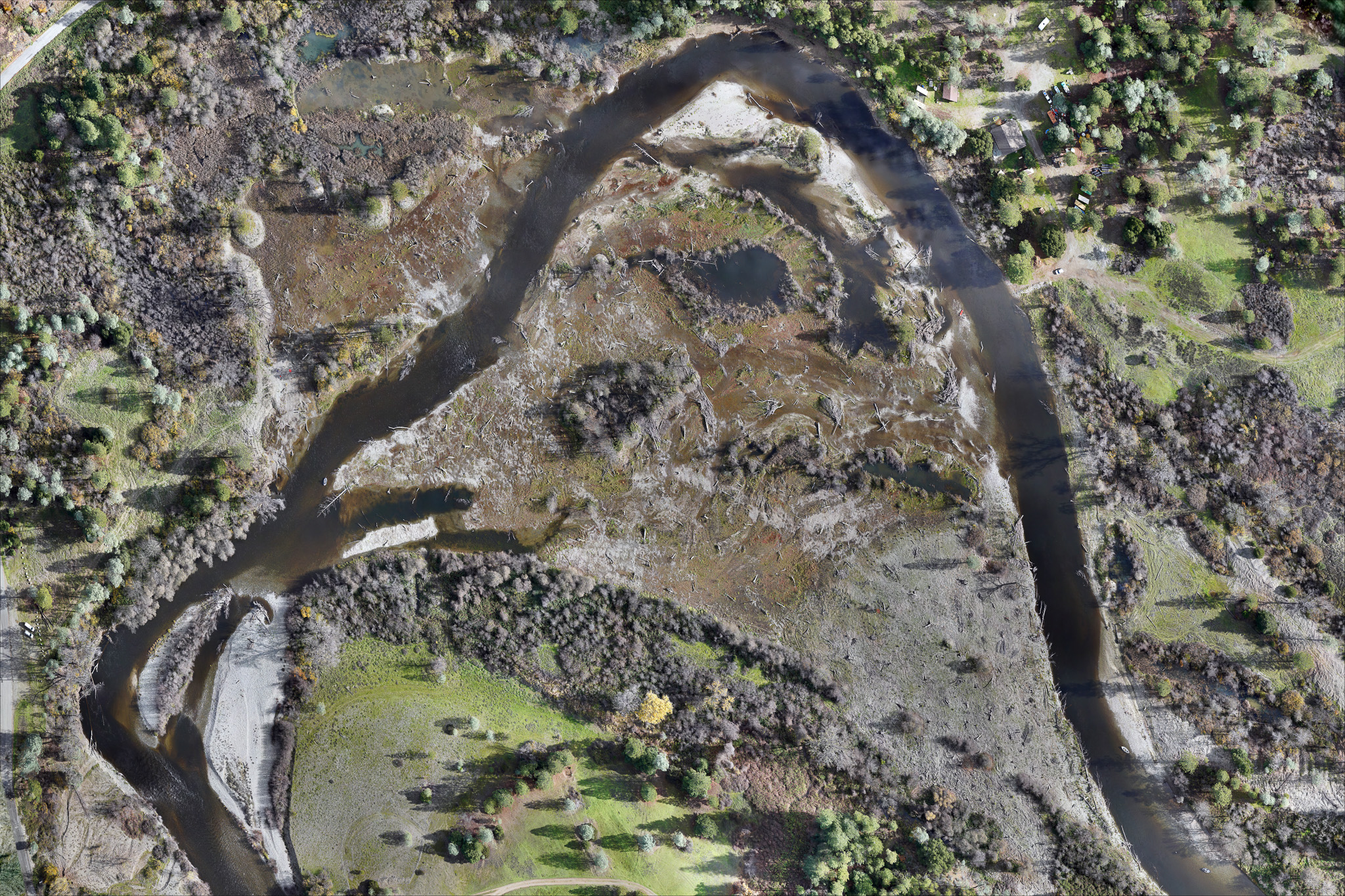
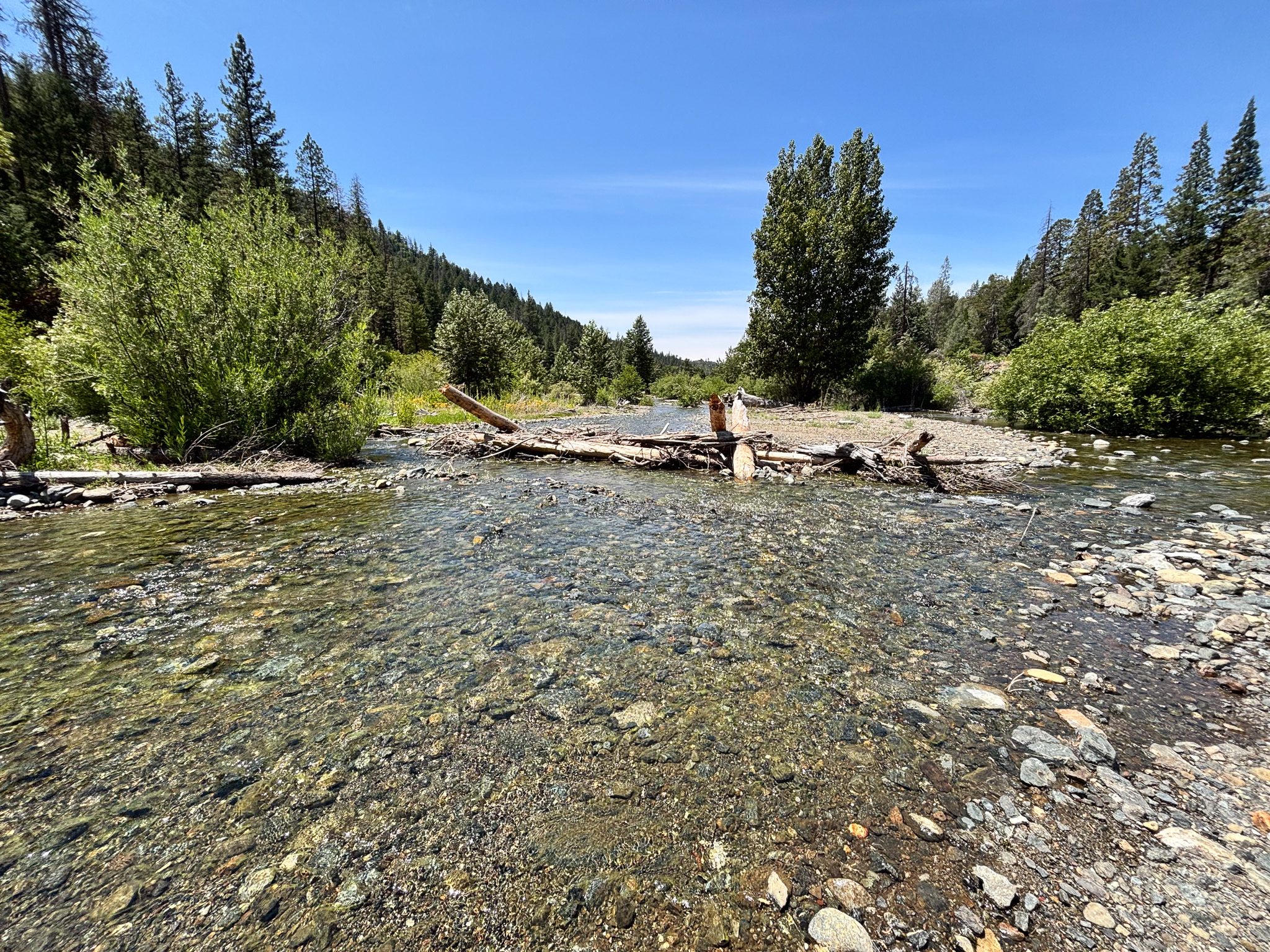
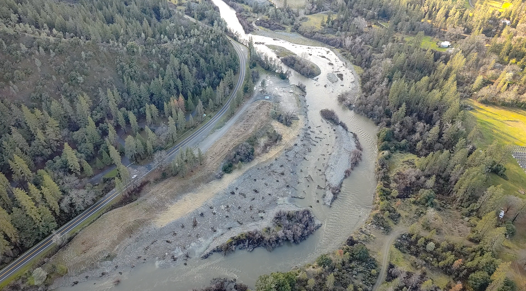
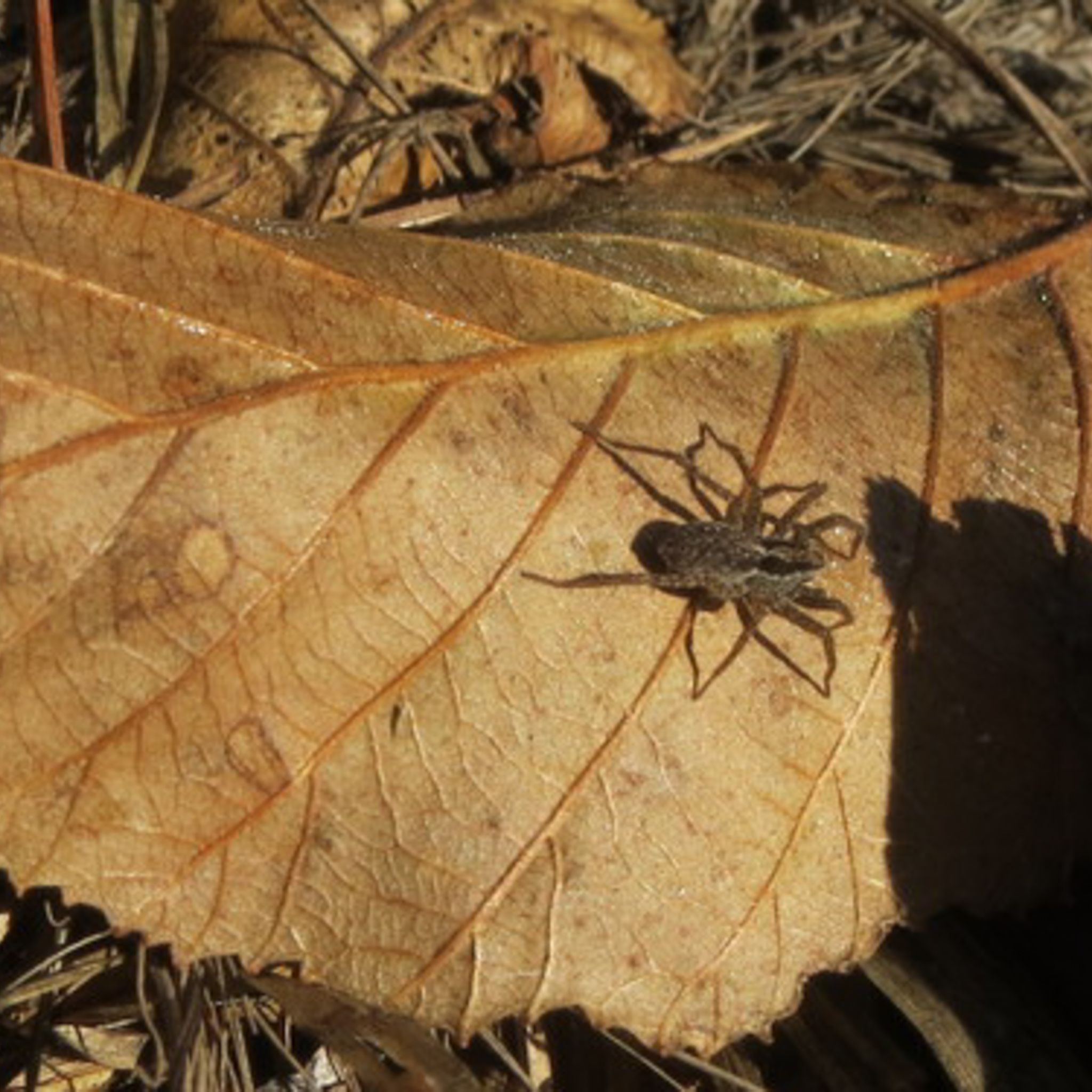
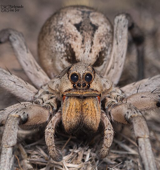
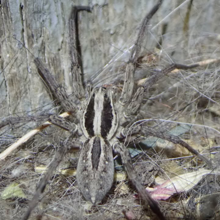

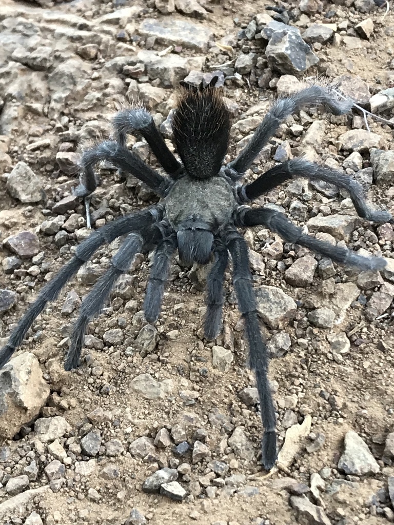
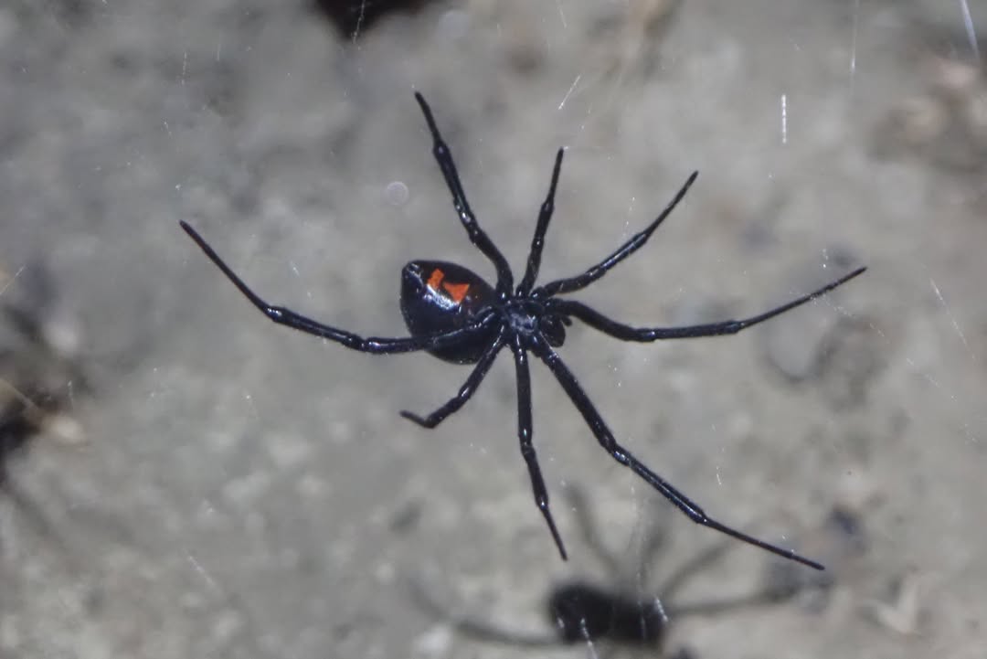
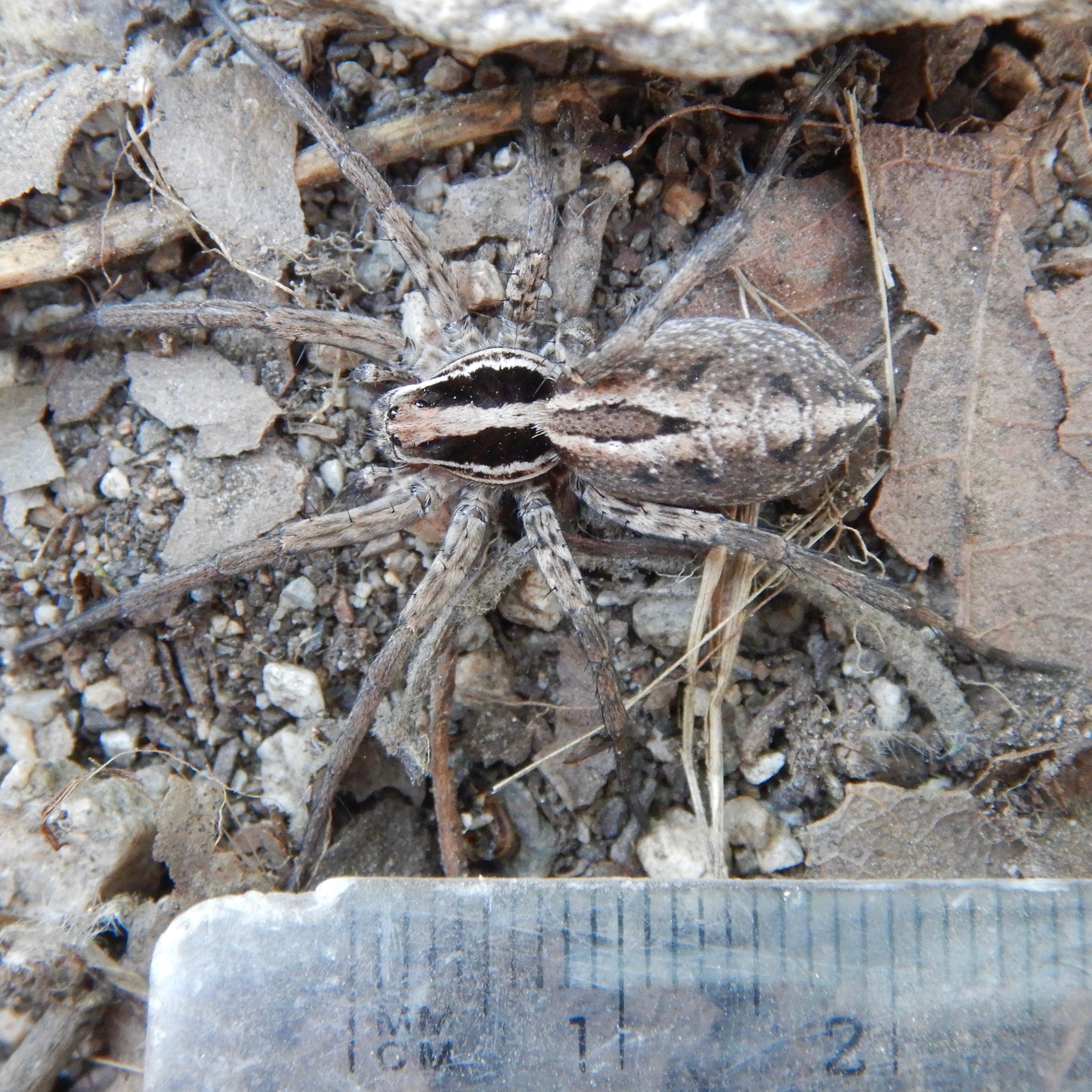
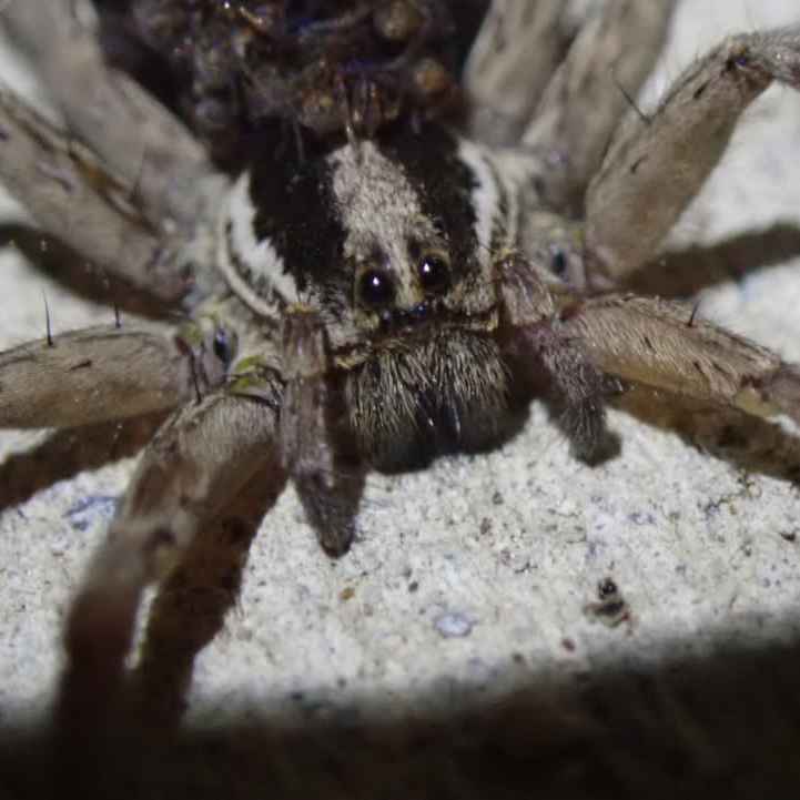
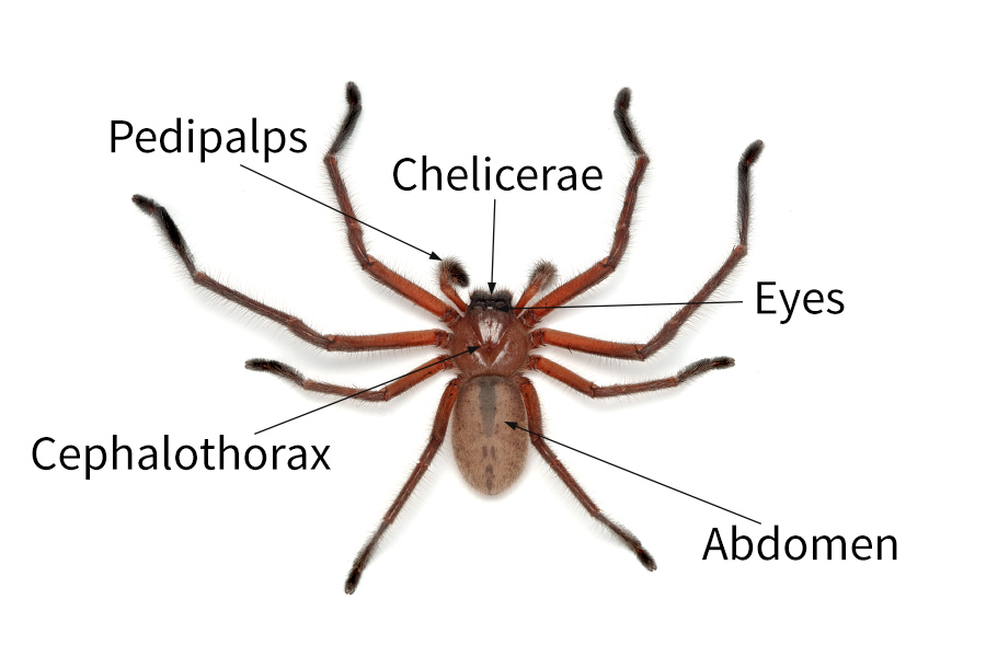
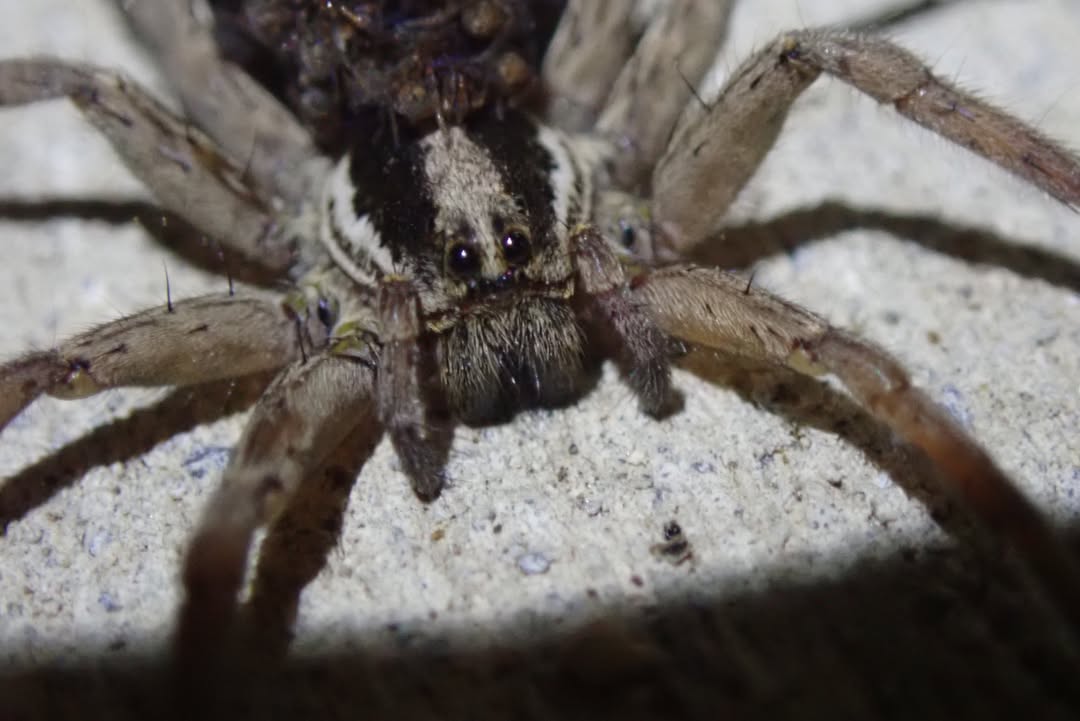
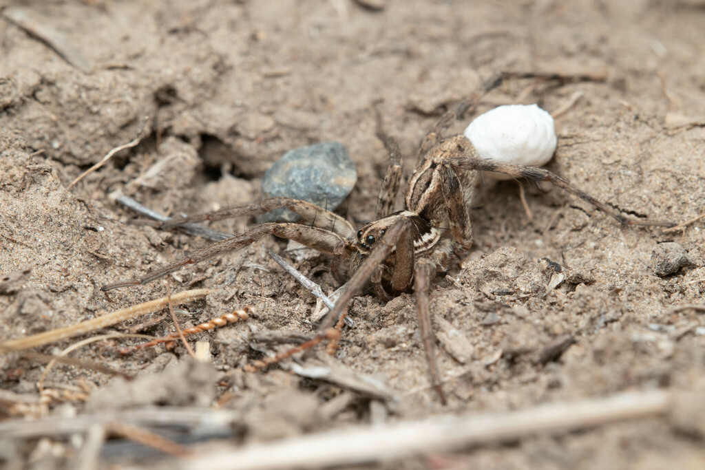

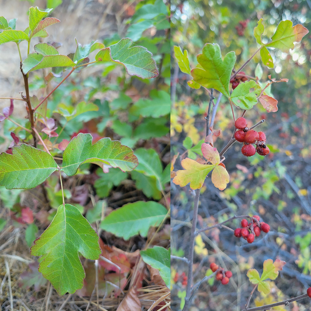
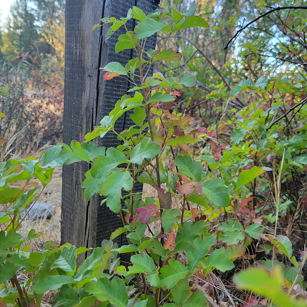
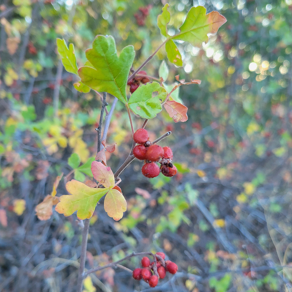
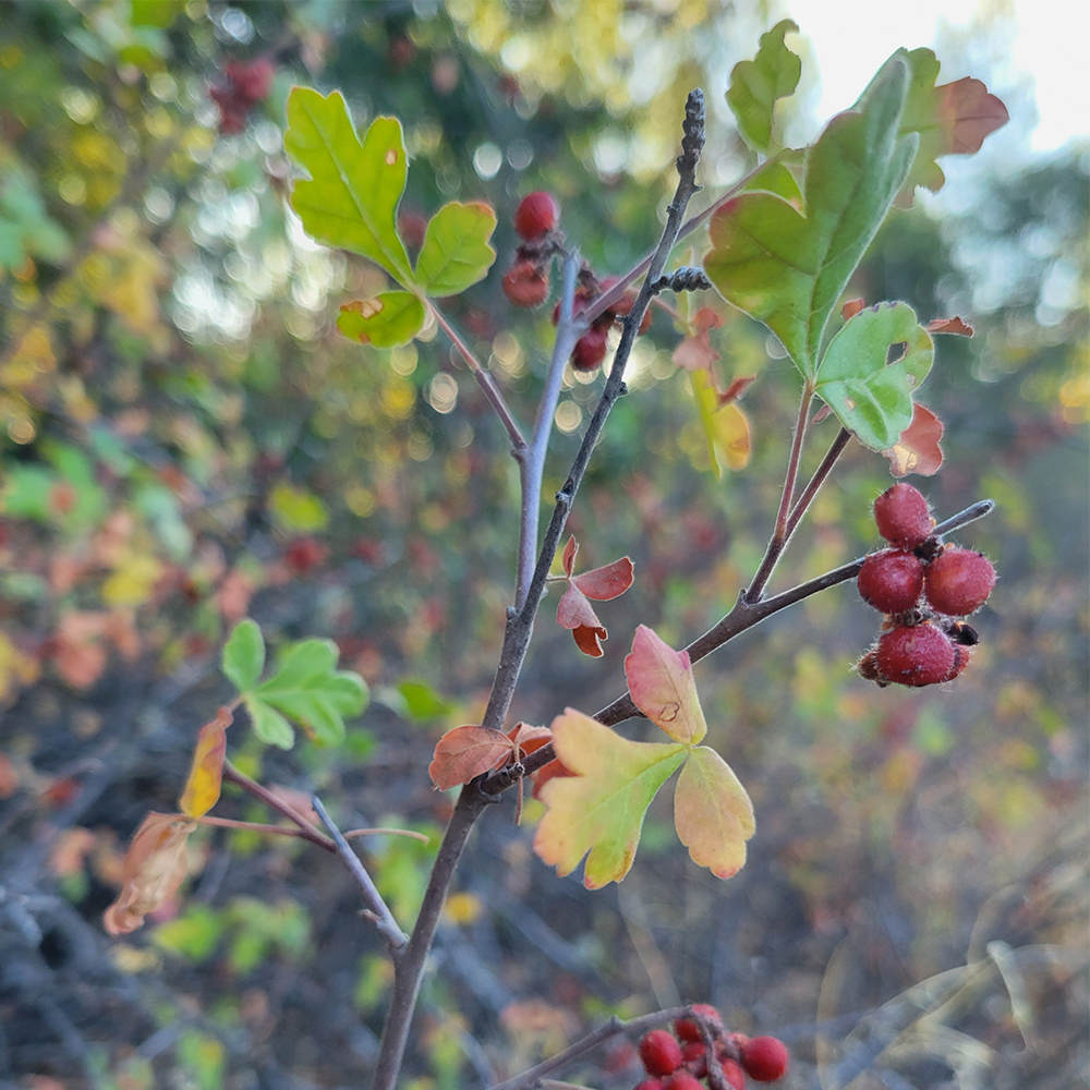
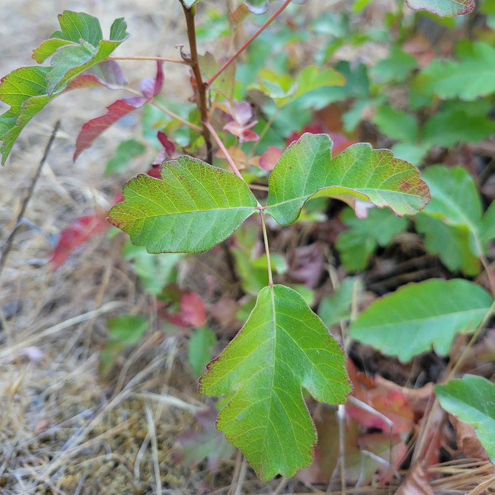
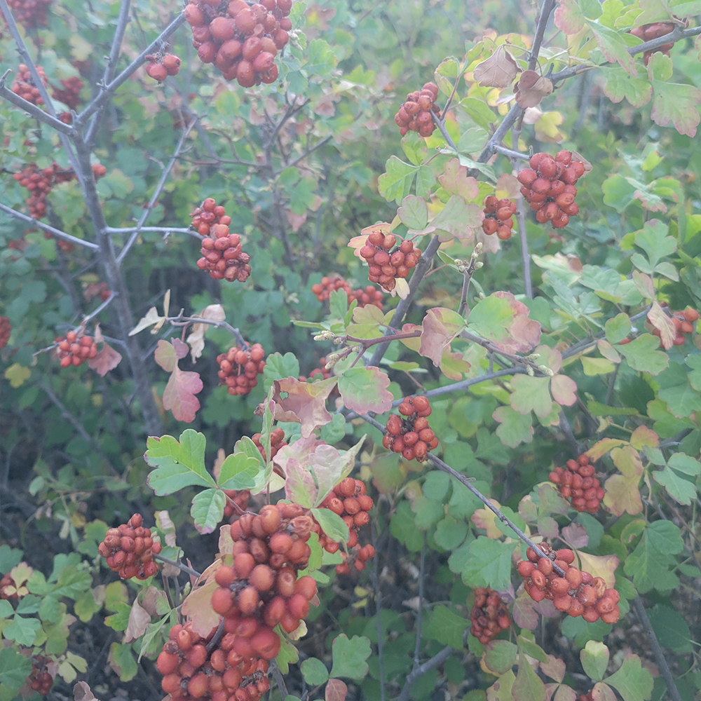
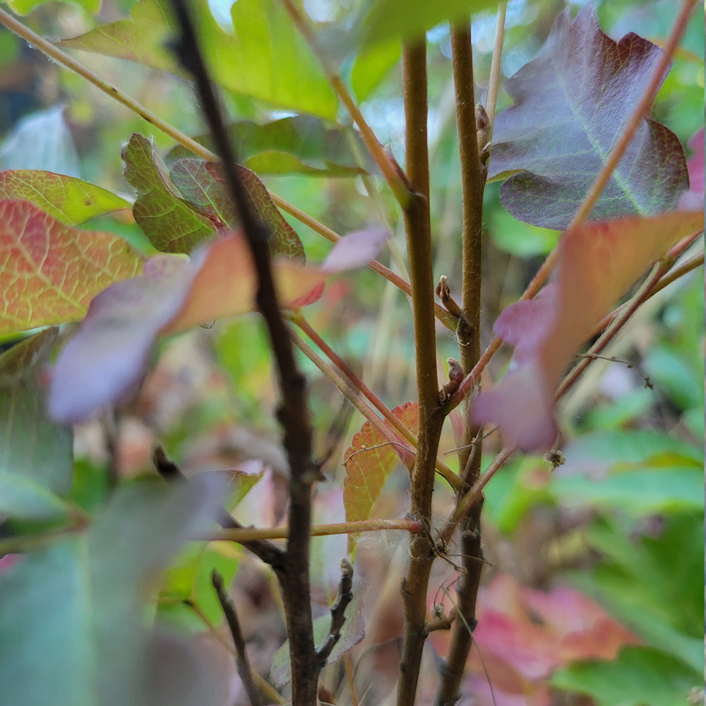
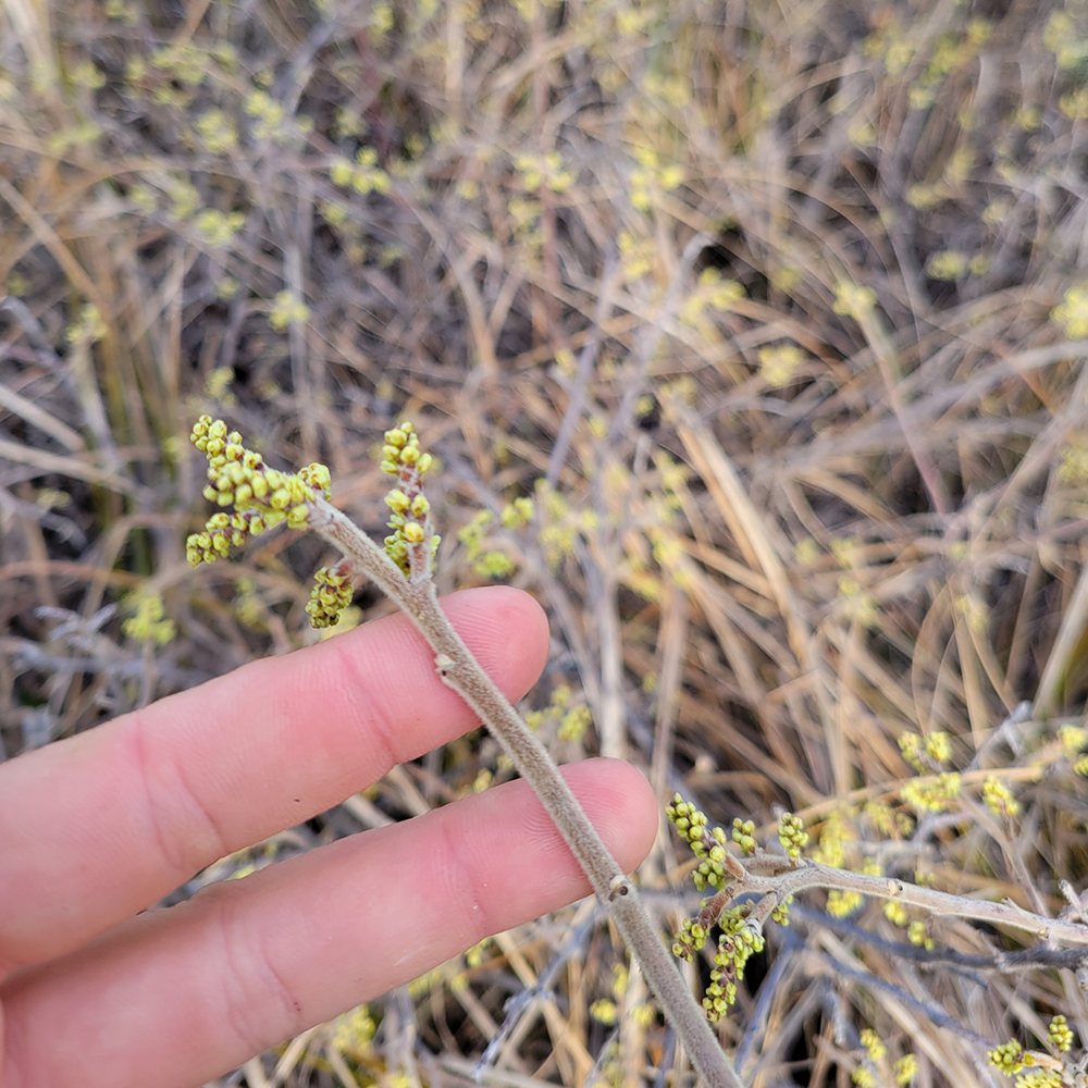
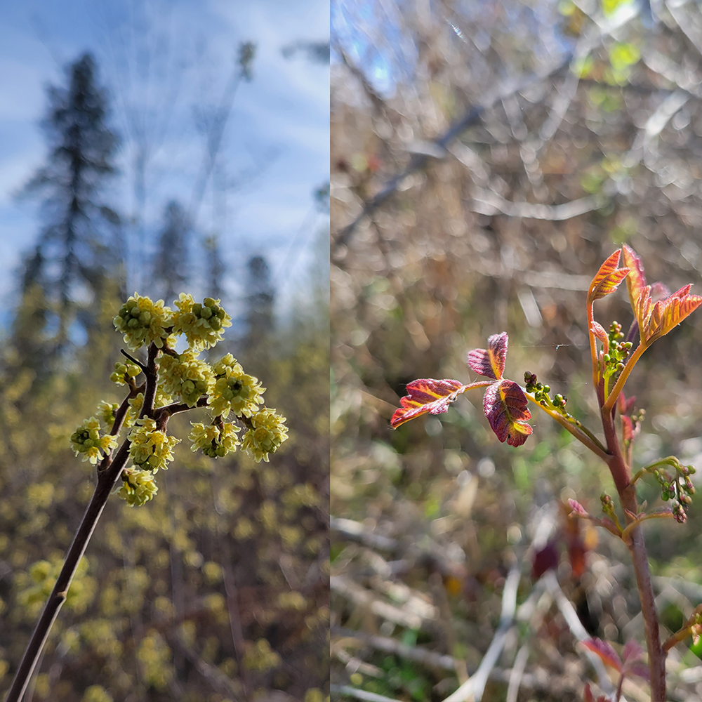
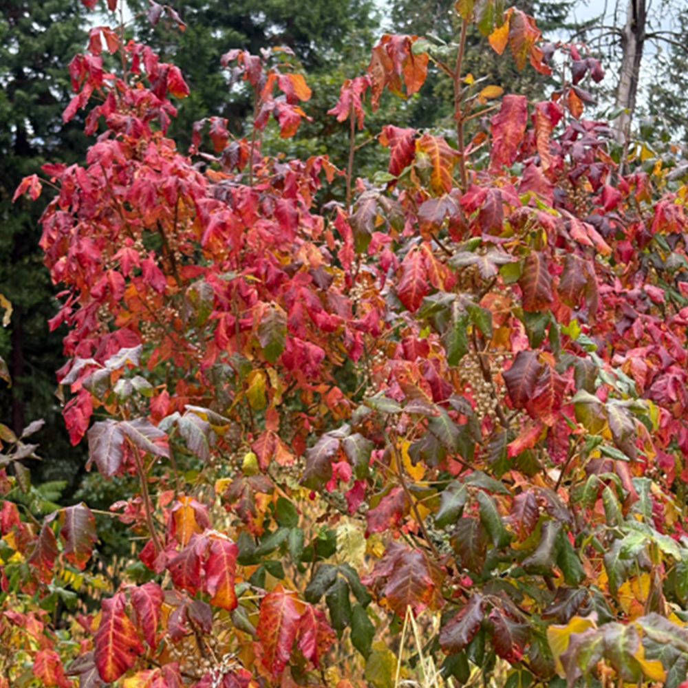
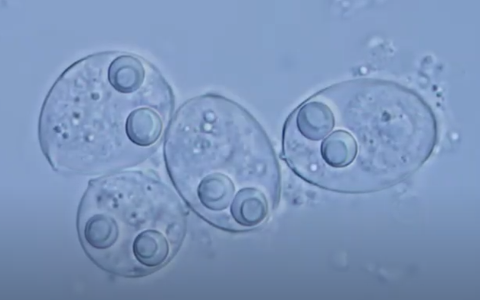
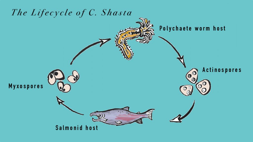
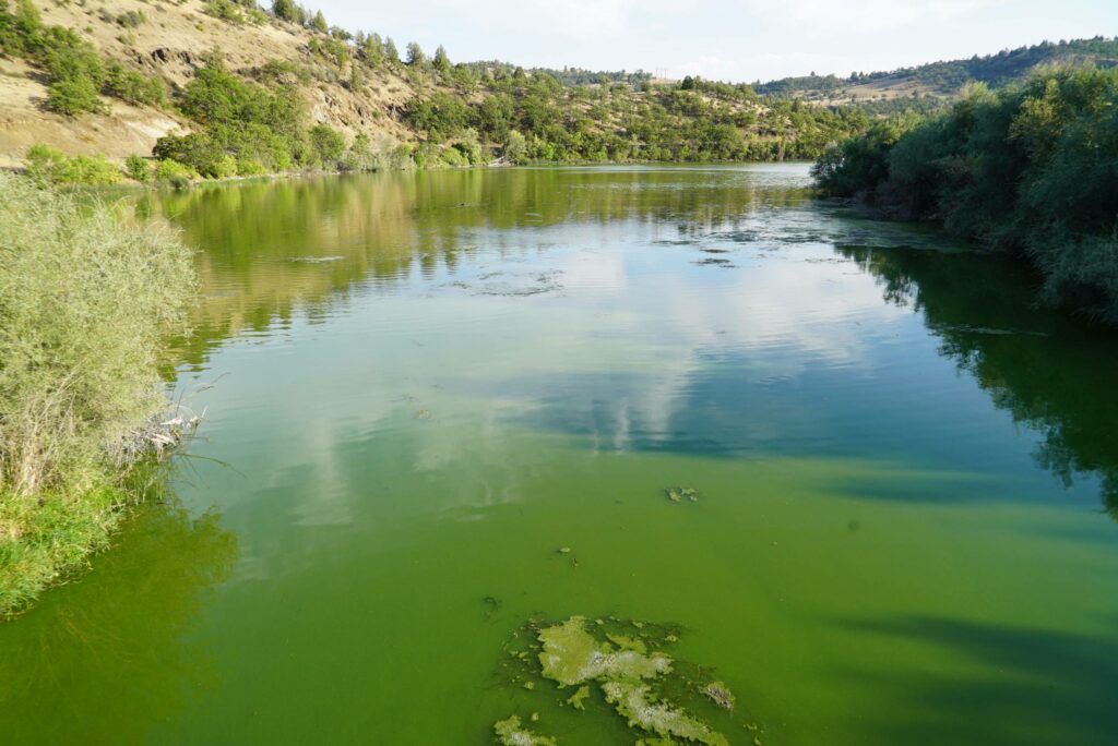
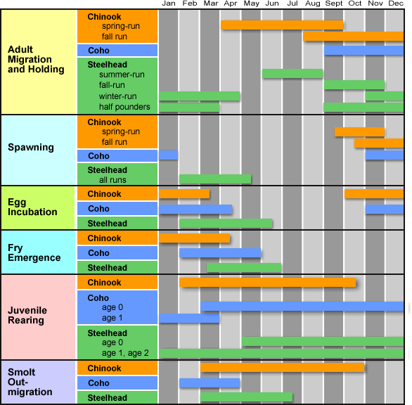
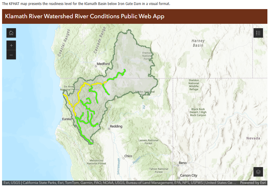
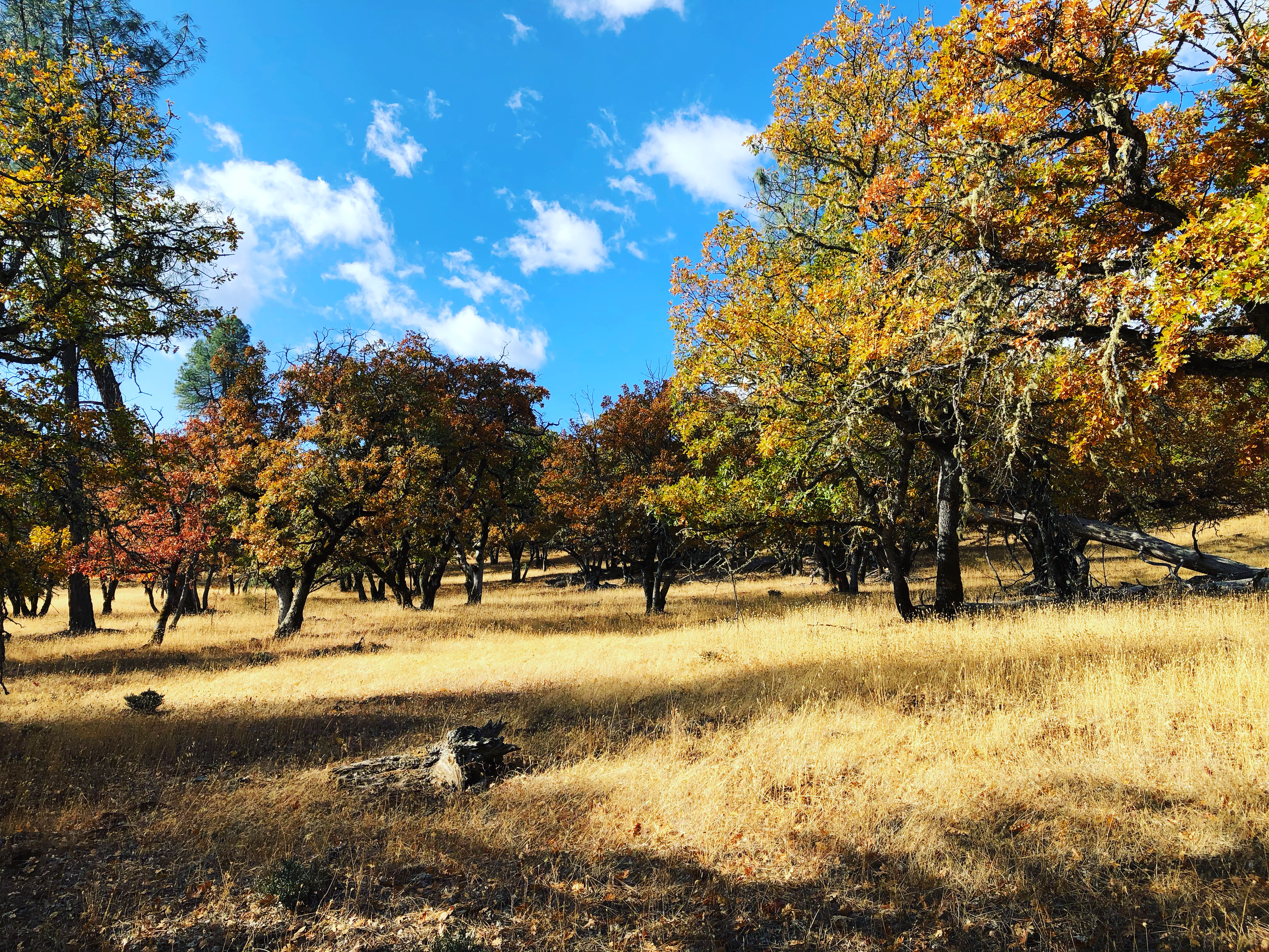
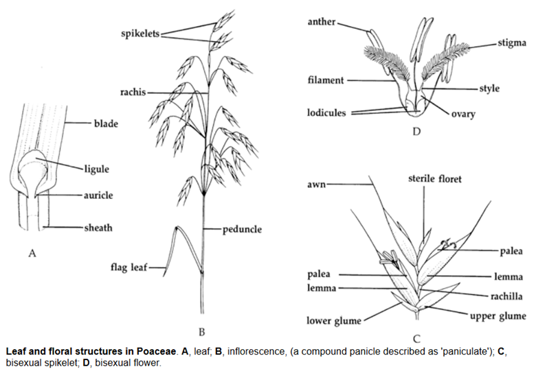

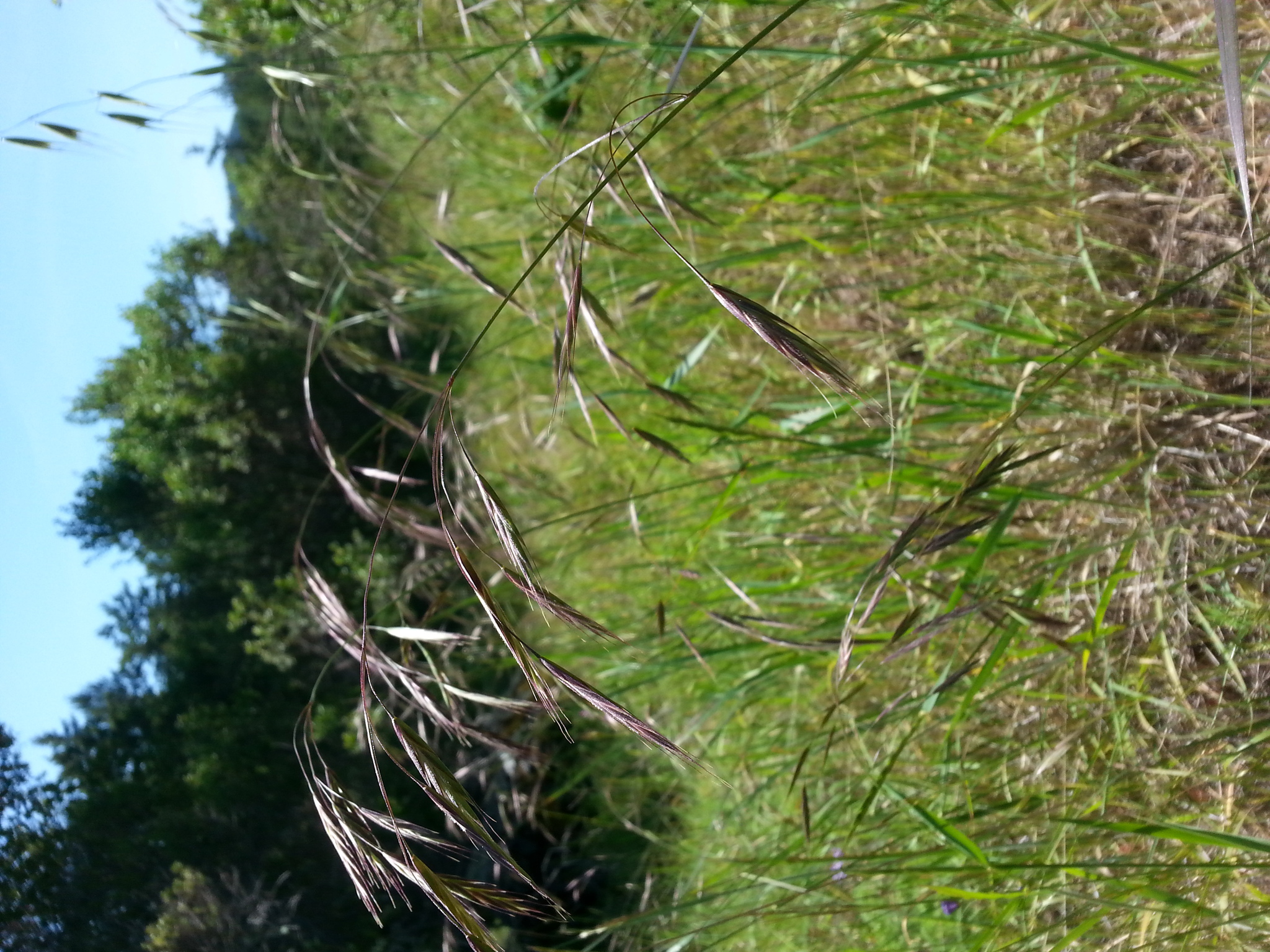

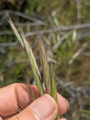
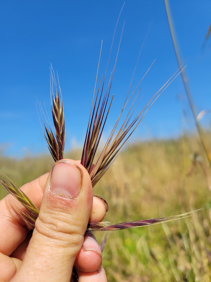
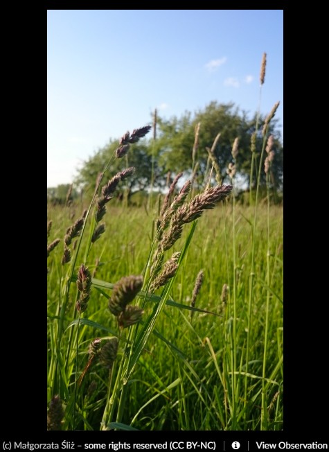
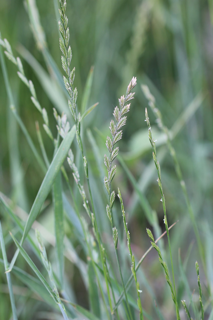
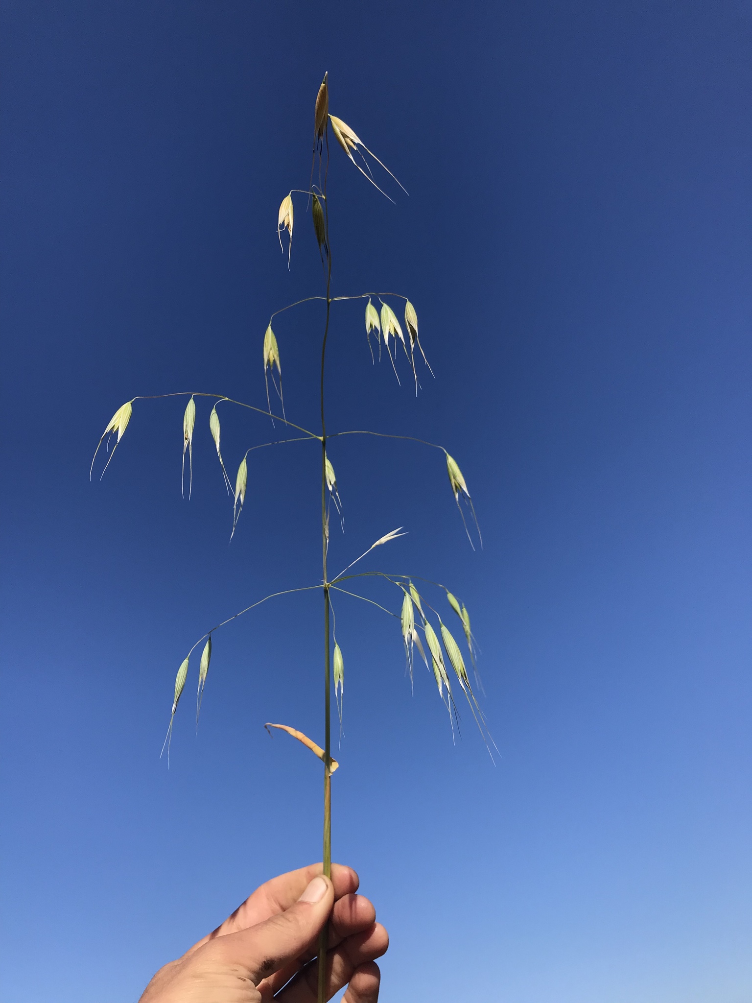
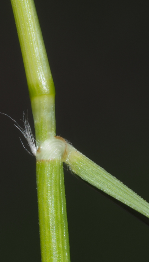
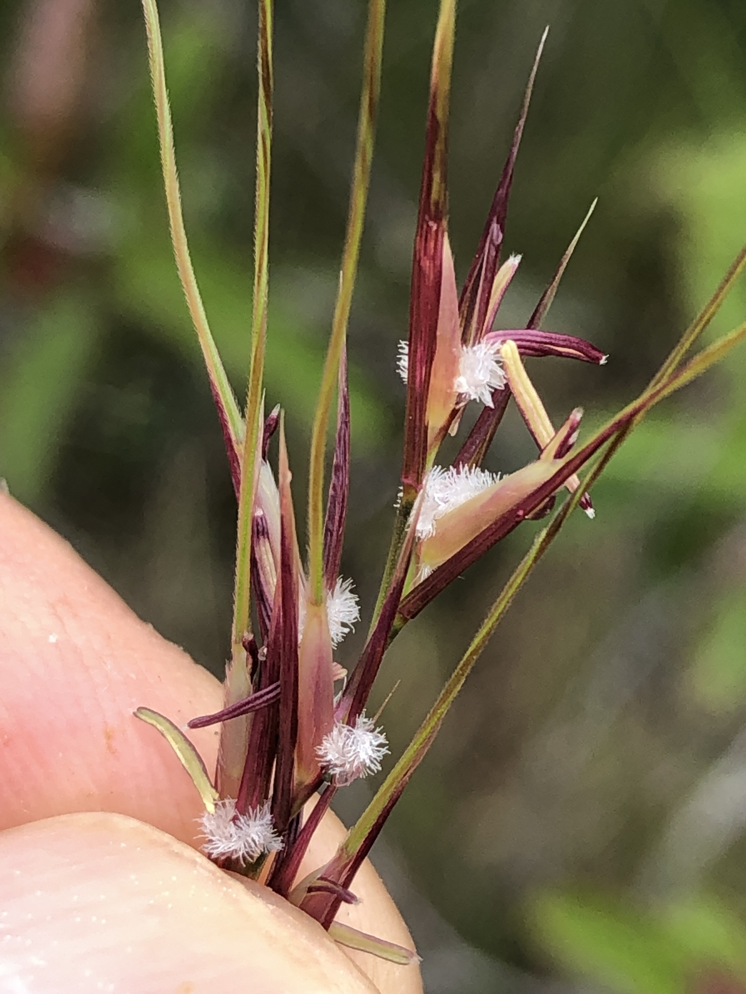
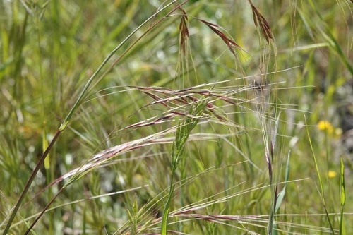
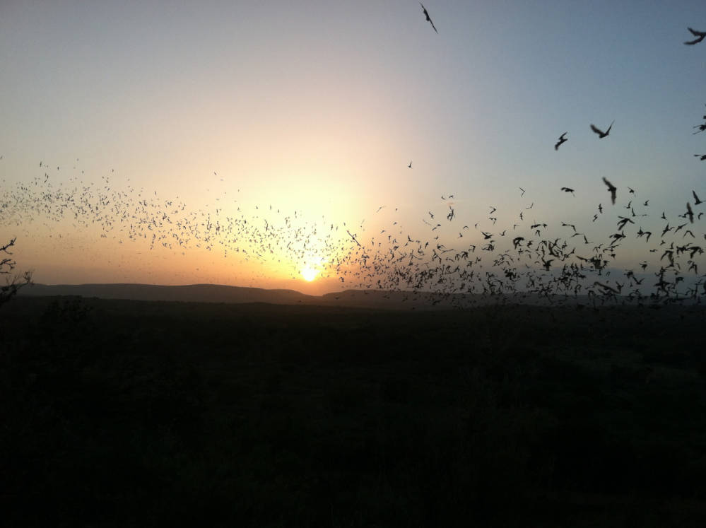
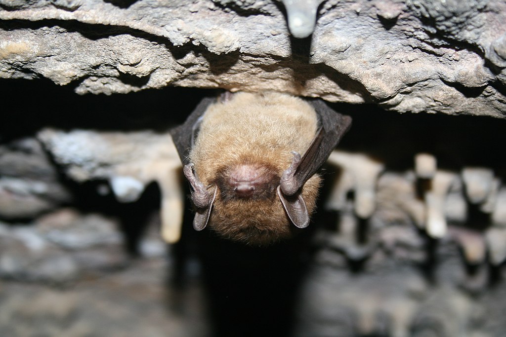
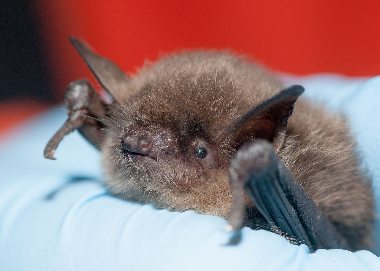
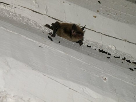

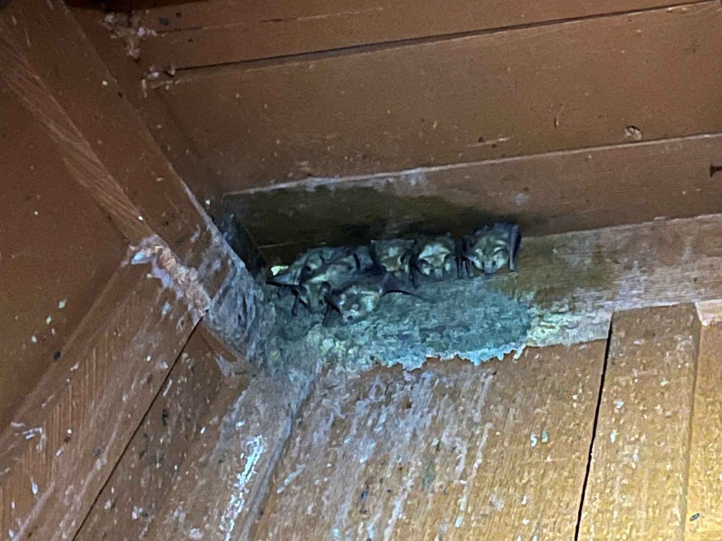
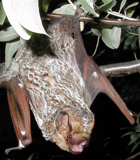
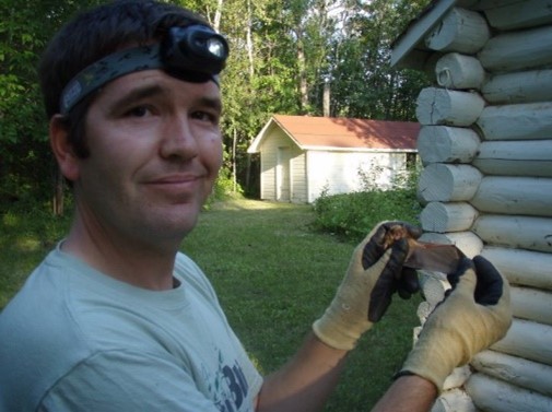
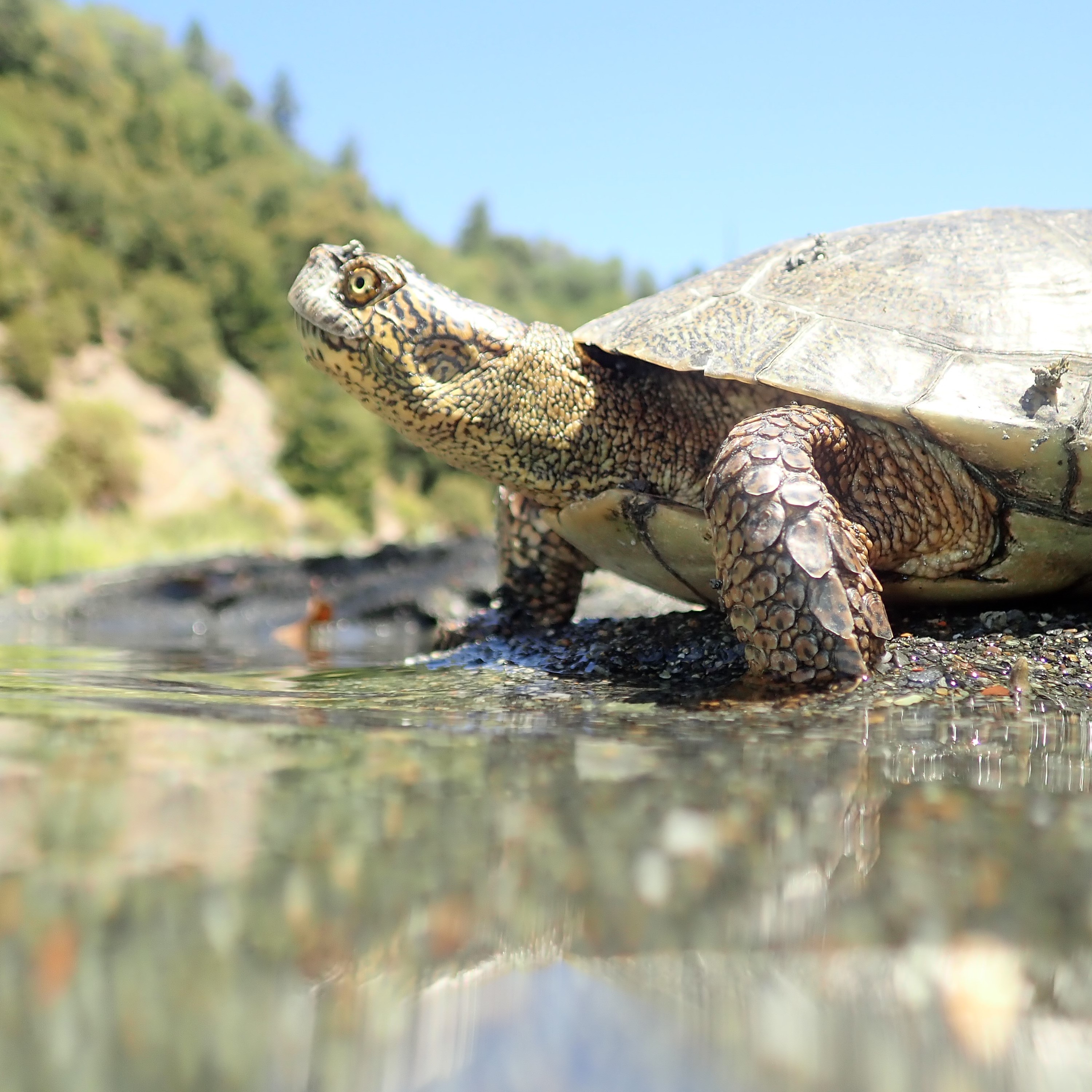
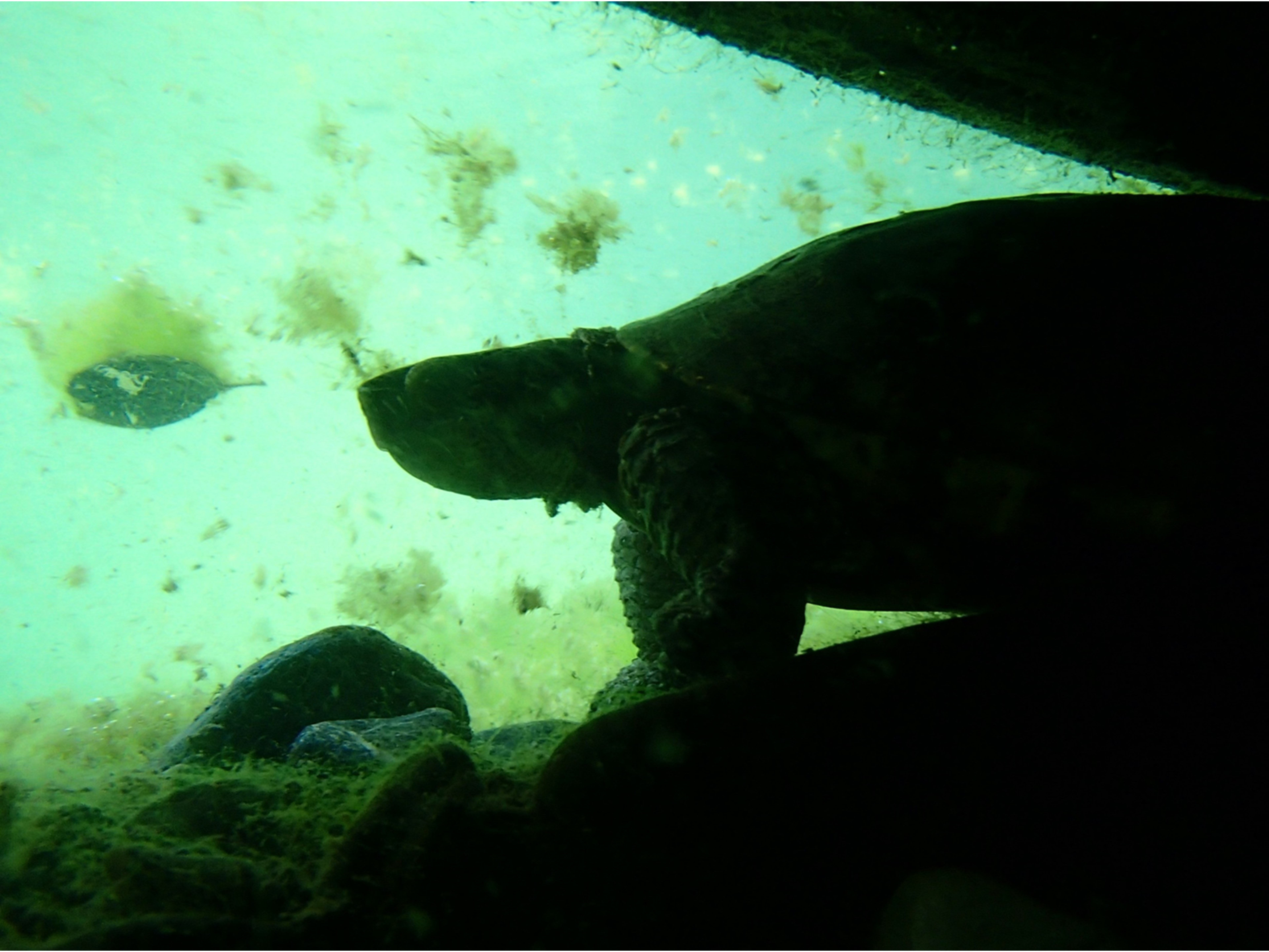
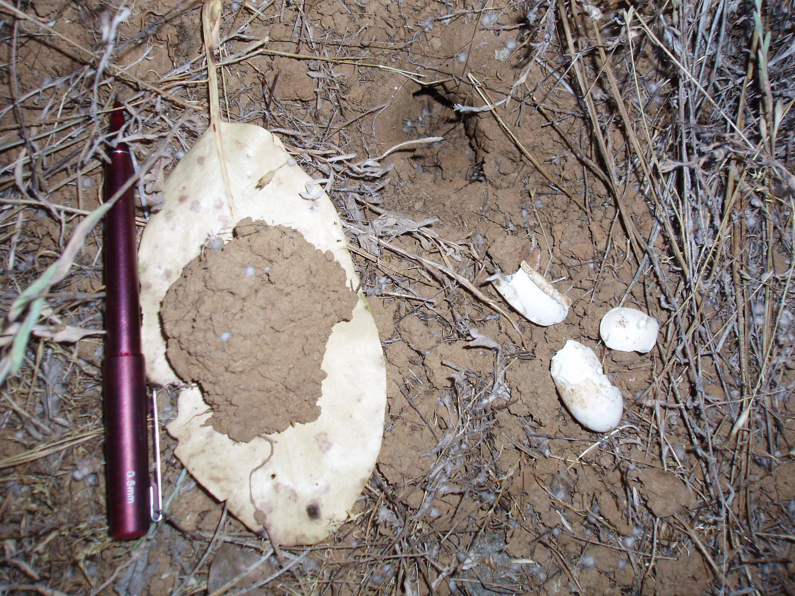
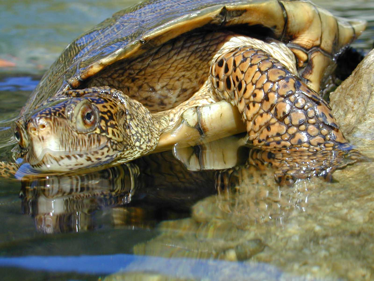
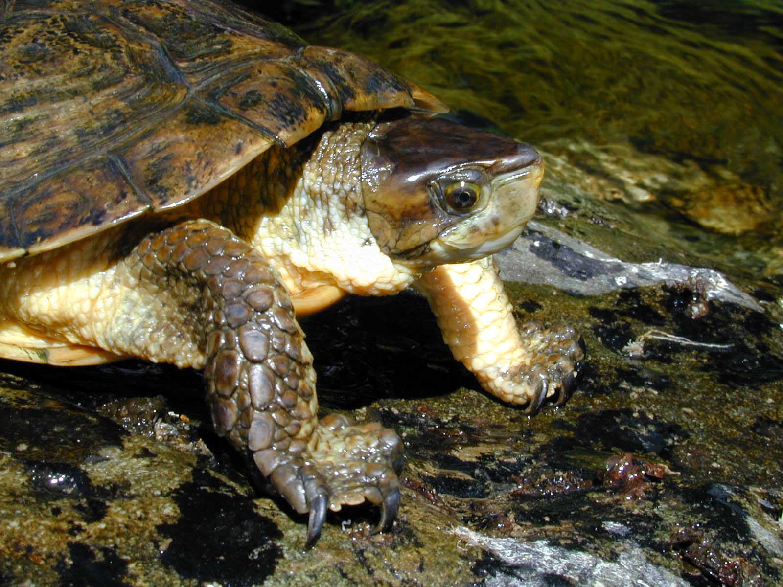
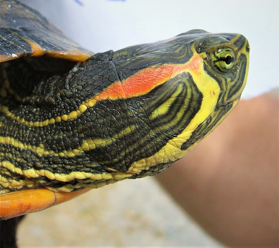
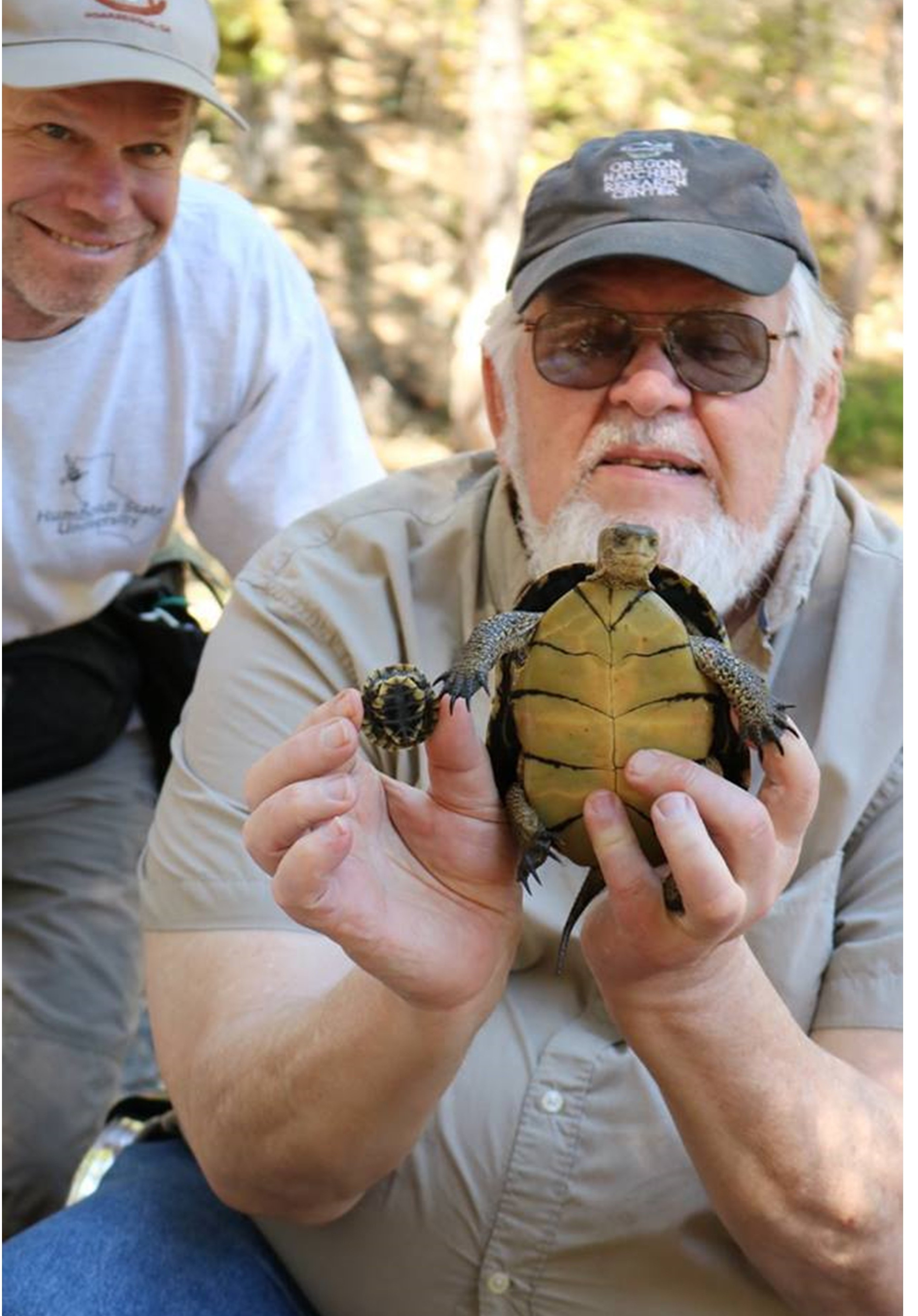
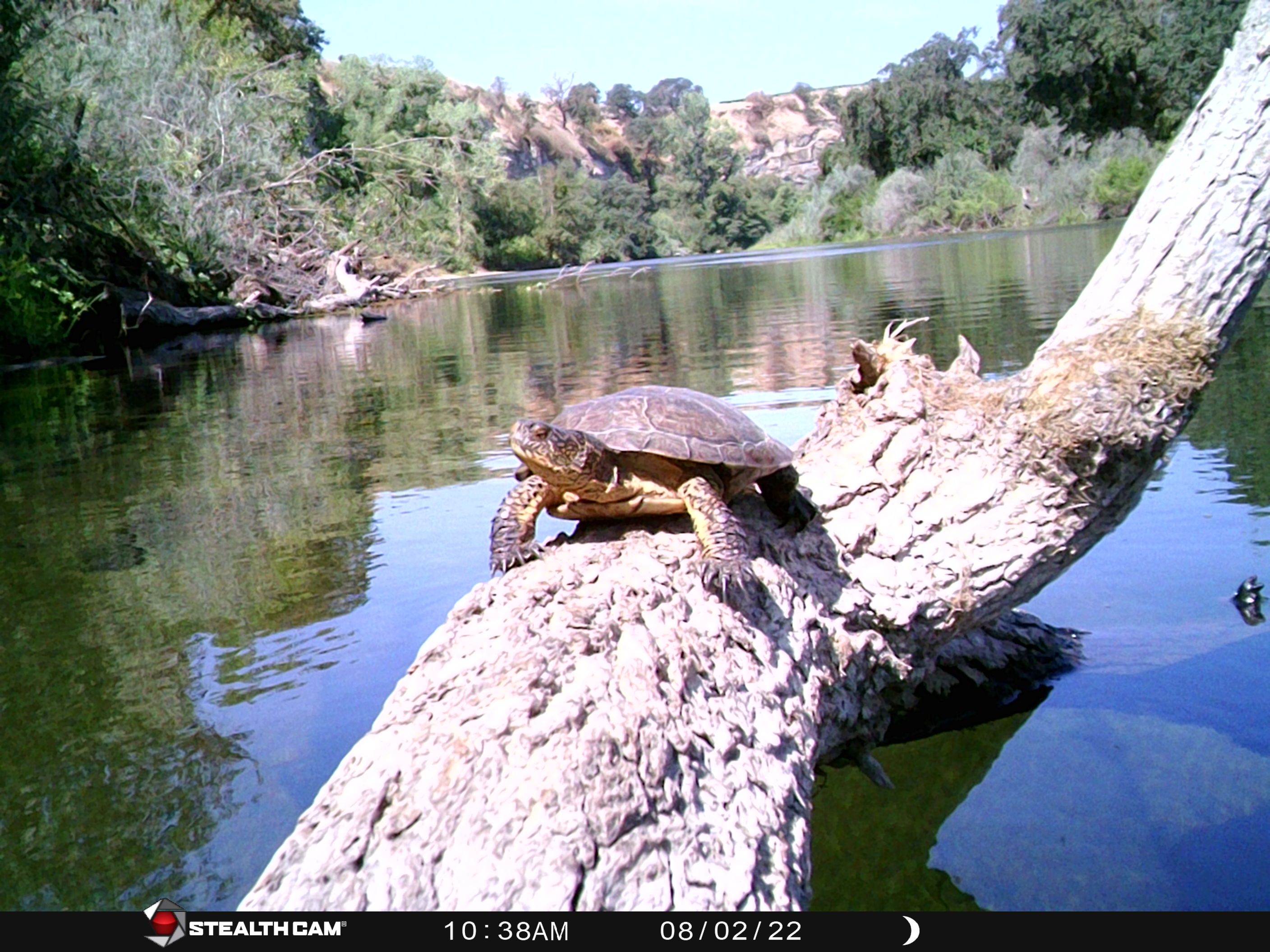
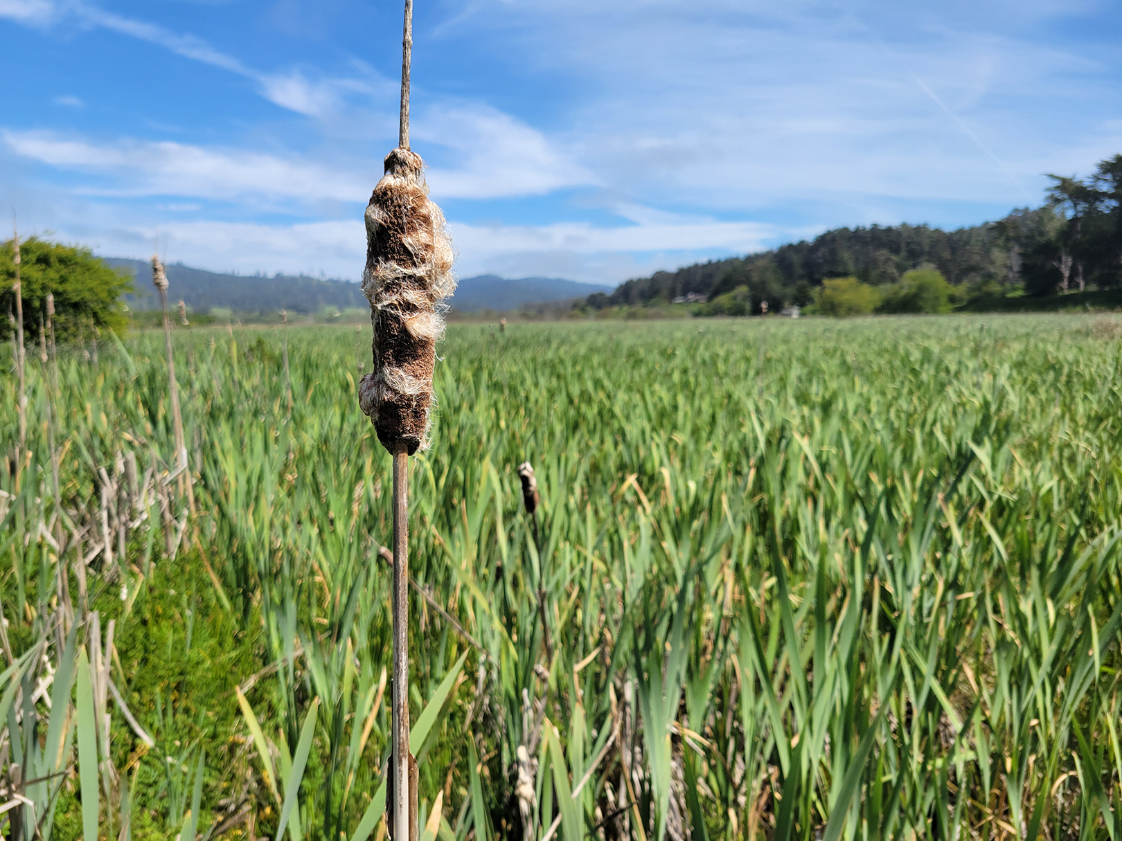
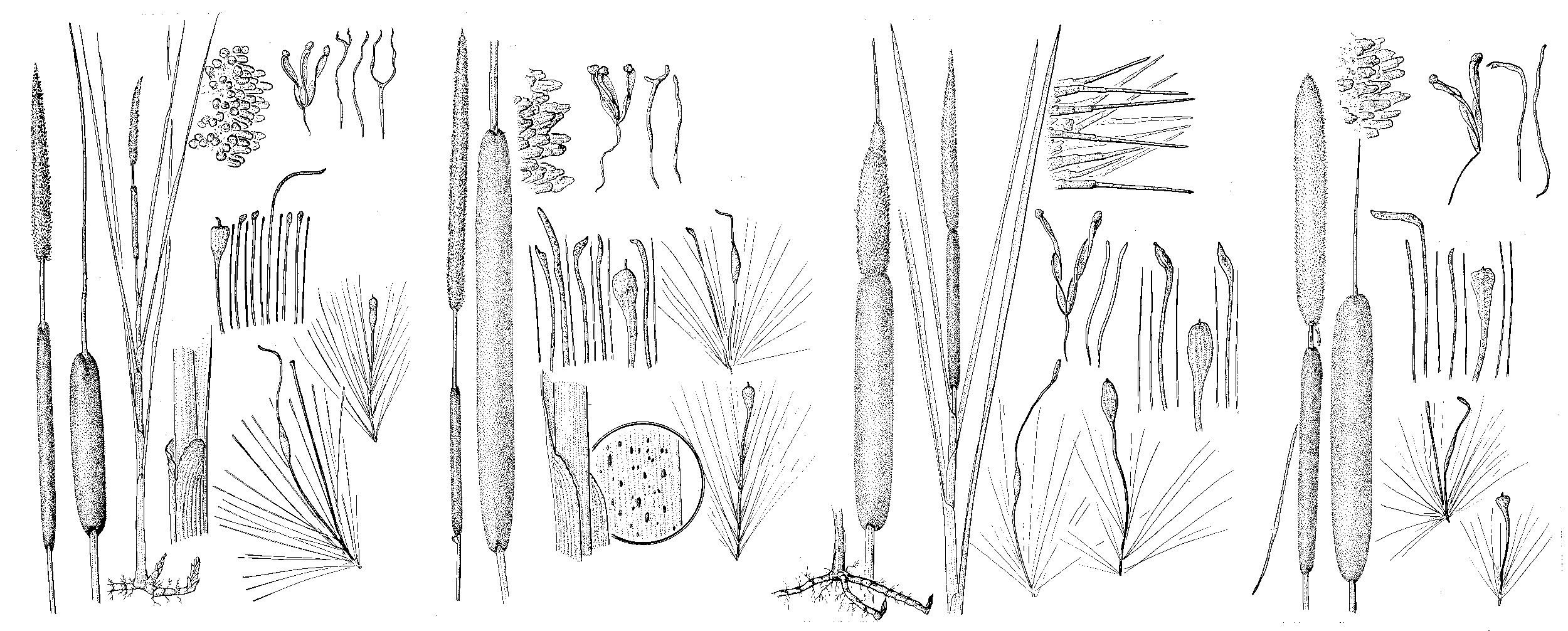
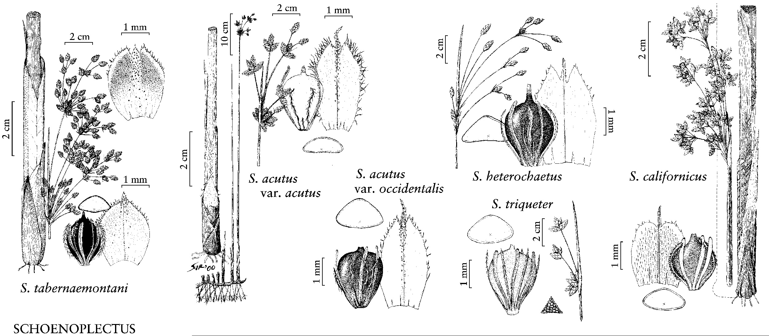
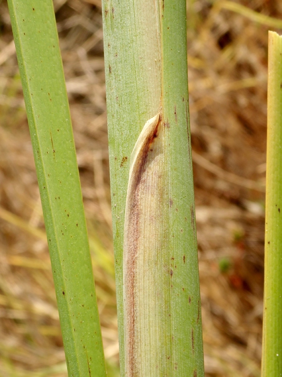
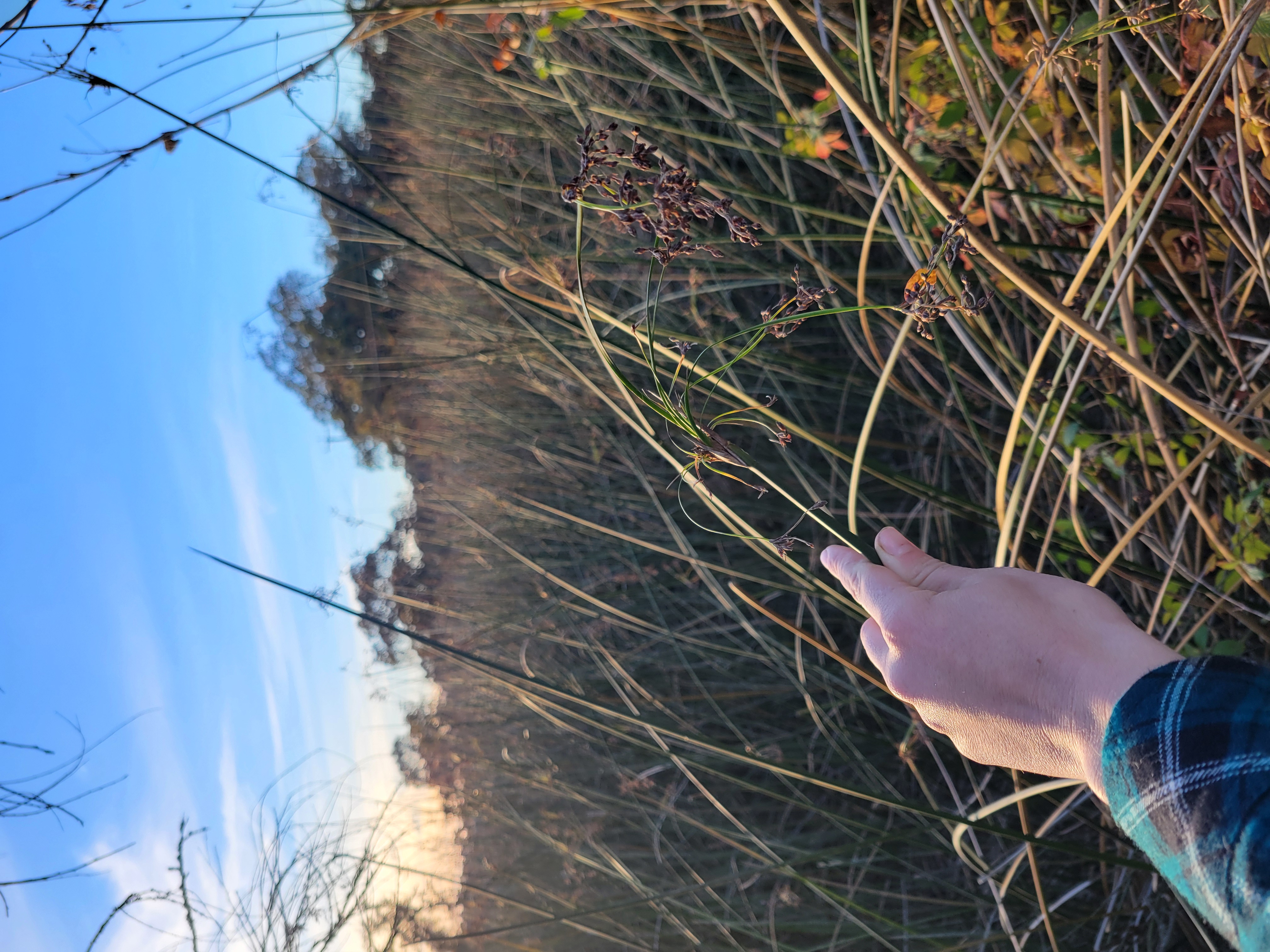
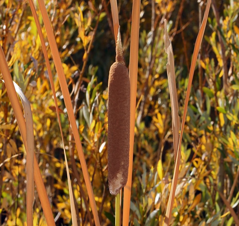
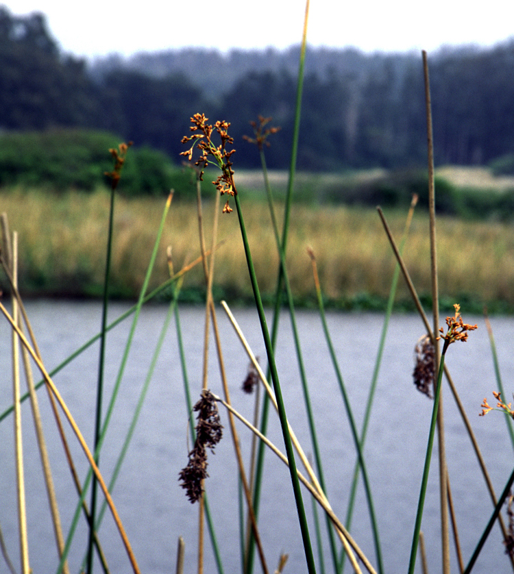
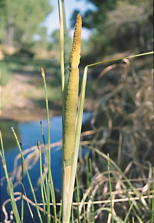
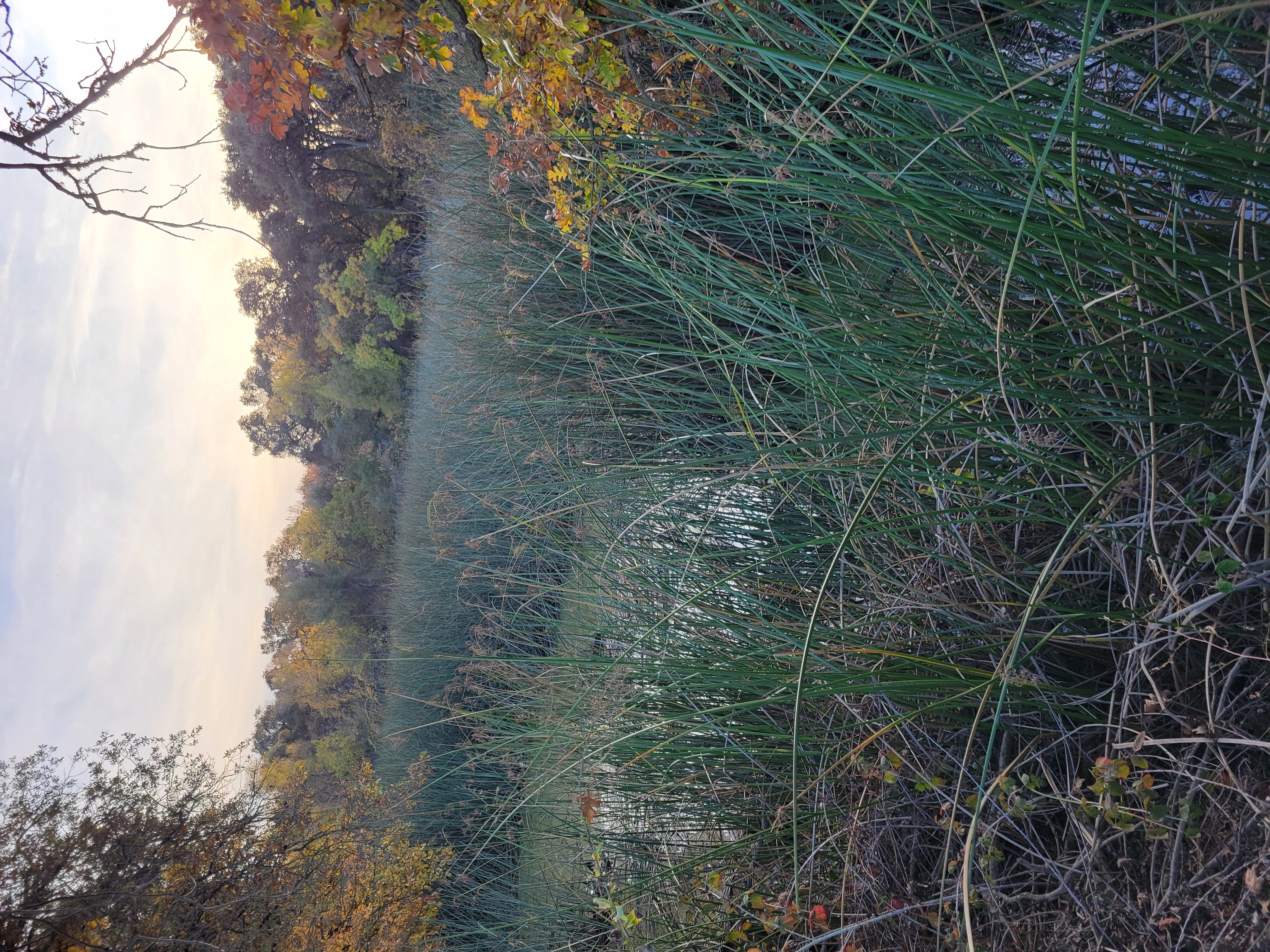
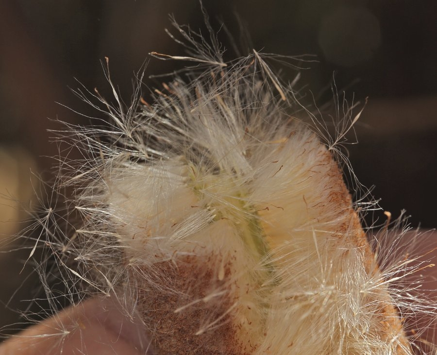
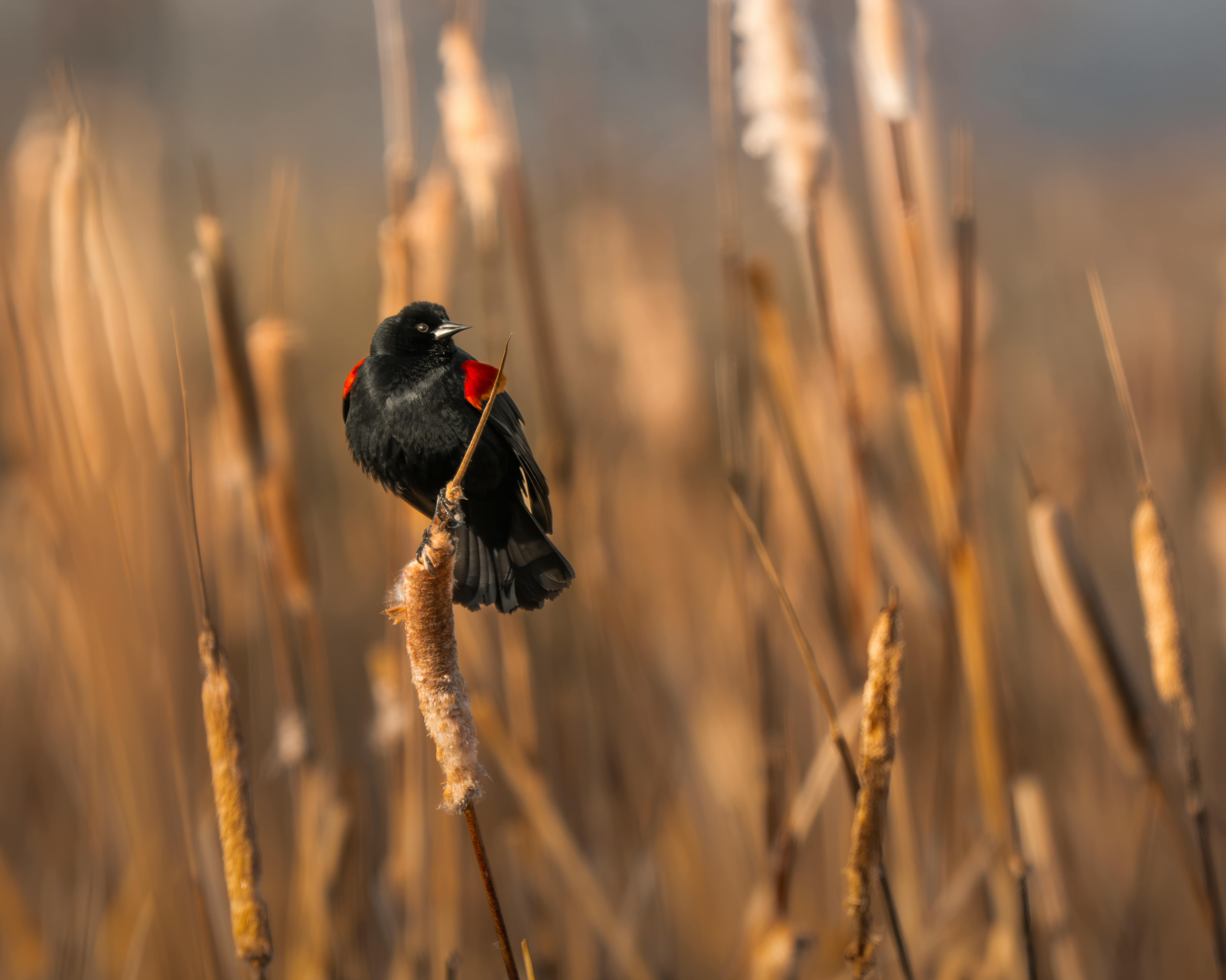
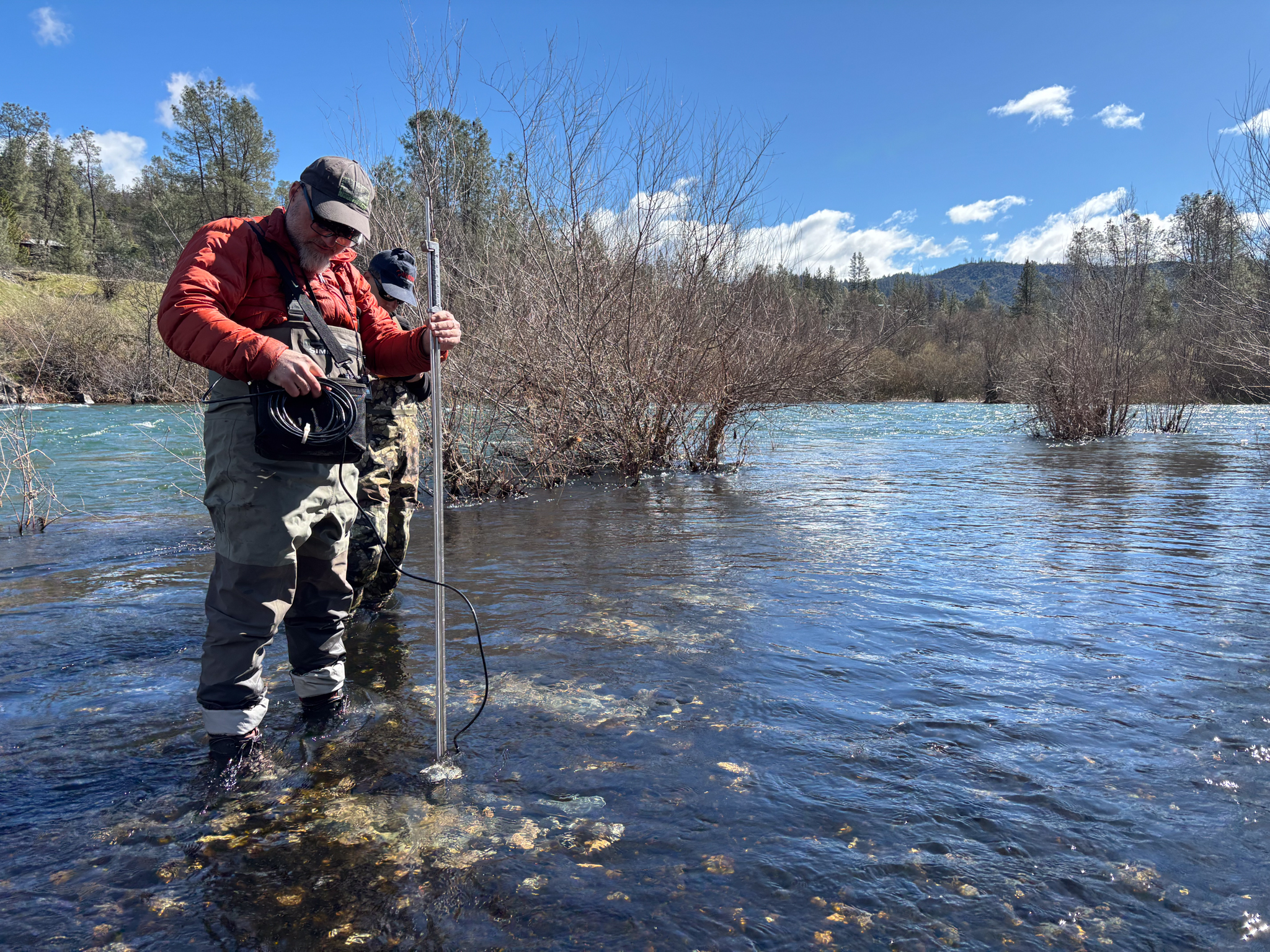

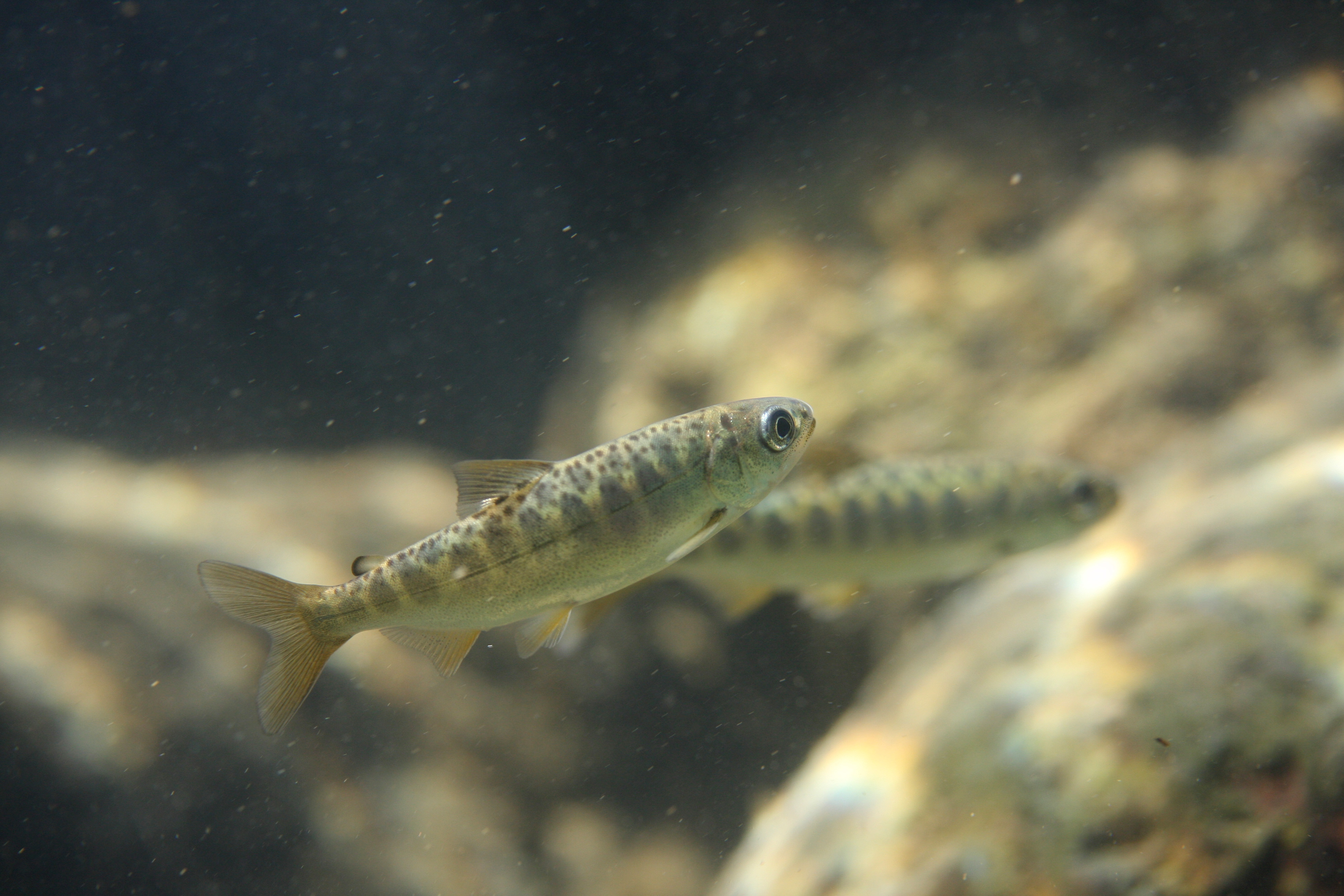
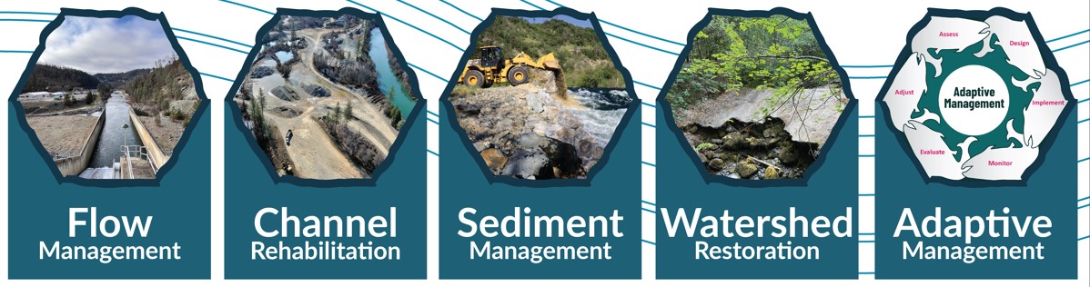
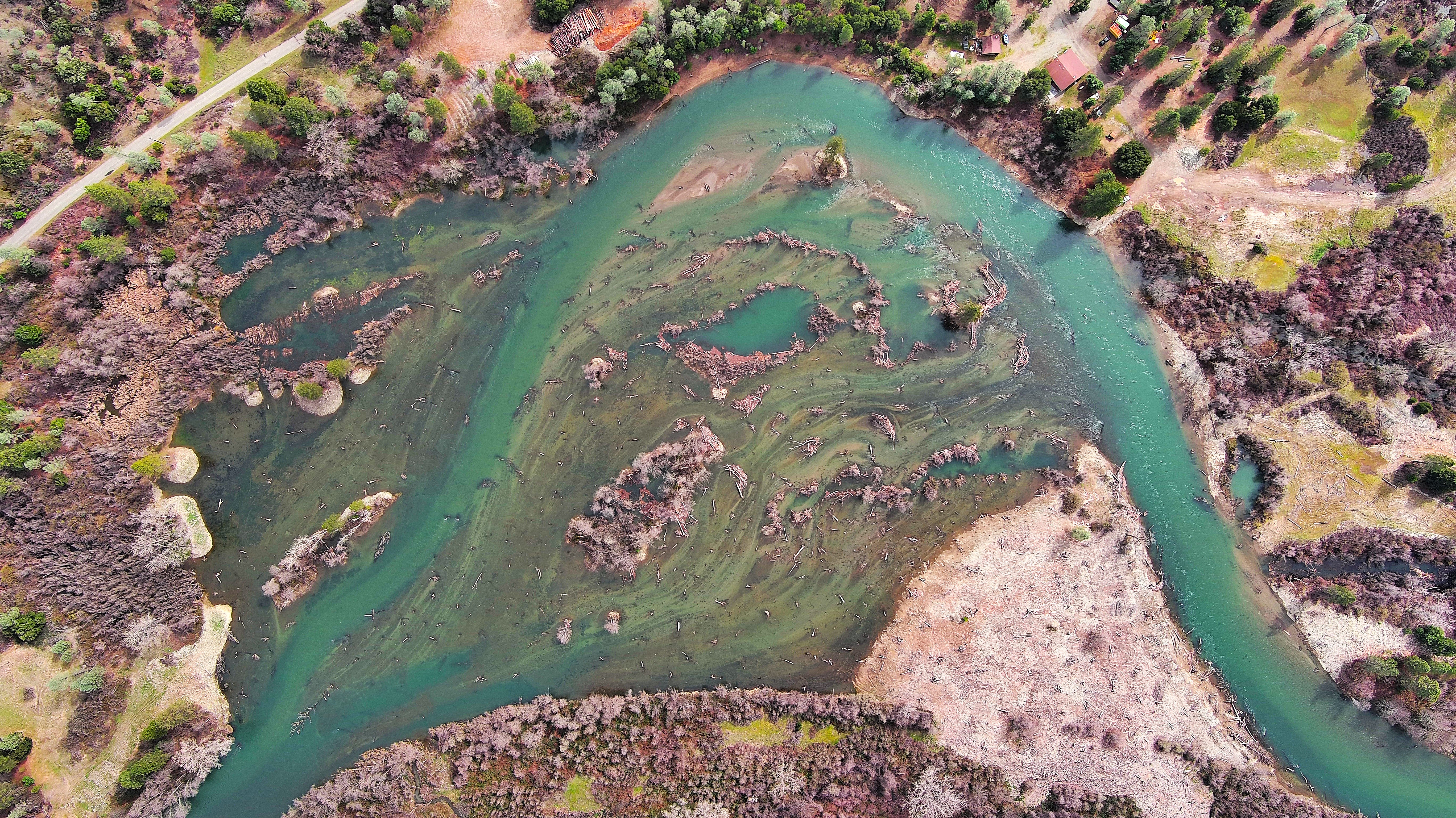